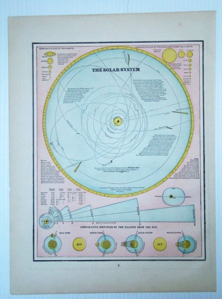
1889 Map of the Solar System, Illustrating Comparative Distances of the Planets From the Sun
Livres anciens et modernes
Artist Unknown
W.H. Stewart,
1889
1889 Map of the Solar System, Illustrating Comparative Distances of the Planets From the Sun
Livres anciens et modernes
Artist Unknown
W.H. Stewart,
1889
99,95 €
(Ladysmith,
Canada)
Mode de Paiement
- PayPal
- Carte bancaire
- Virement bancaire
- Pubblica amministrazione
- Carta del Docente
Détails
- Année
- 1889
- Lieu d'édition
- Rochester, NY
- Auteur
- Artist Unknown
- Éditeurs
- W.H. Stewart
- Format
- Folio - over 12" - 15" tall
- Edition
- First Edition Thus
- Thème
- 1889 Map of the Solar System, Illustrating Comparative Distances of the Planets From the Sun, planet sizes, neap tides, spring tides, lunar eclipse and solar Eclipse Maps Antiquarian
- Description
- Map
- Etat de conservation
- Tres bonne condition
- Langues
- Anglais
- Premiére Edition
- True
Description
Vintage color map. Includes illustrations of comparative planet sizes, neap tides, spring tides, lunar eclipse and solar eclipse. Outer dimensions: 10.75" x 14.5". Unmarked with Light wear. Book