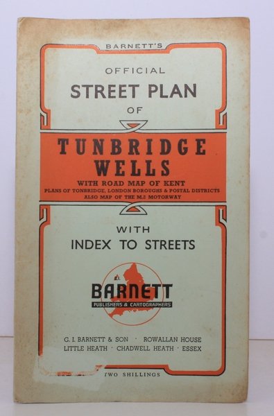
Barnett's Official Street Plan of Tunbridge Wells. With Road Map of Kent, Plans of Tonbridge, London Boroughs & Postale Districts. Also Map of the M2 Motorway. BRIGHT, CLEAN COPY
Livres anciens et modernes
Tunbridge Wells.
G.I. Barnett, Chadwell Heath,
1960
Barnett's Official Street Plan of Tunbridge Wells. With Road Map of Kent, Plans of Tonbridge, London Boroughs & Postale Districts. Also Map of the M2 Motorway. BRIGHT, CLEAN COPY
Livres anciens et modernes
Tunbridge Wells.
G.I. Barnett, Chadwell Heath,
1960
13,80 €
(Devon,
Royaume-Uni)
Mode de Paiement
- PayPal
- Carte bancaire
- Virement bancaire
- Pubblica amministrazione
- Carta del Docente
Détails
- Année
- 1960
- Auteur
- Tunbridge Wells.
- Éditeurs
- G.I. Barnett, Chadwell Heath
- Thème
- topography, kent, tunbridge wells, tonbridge, maps, street plans
- Langues
- Anglais
Description
Folding street plan in red and black on paper, measuring 25.0 x 20.0 ins (approx. 63.5 x 51.0 cms) folding in 16 panels to 9.0 x 5.5 ins (approx. 23.0 x 14.0 cms); original printed wrappers in orange and black, yapped edges, covers very lightly age-soiled else a very good, bright, clean copy. With numerous trade advertisements.