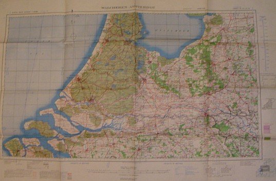
British World War II Map of Walcheren-Amsterdam
Livres anciens et modernes
Geographical Section, General Staff No. 4042
British Military,
1944
British World War II Map of Walcheren-Amsterdam
Livres anciens et modernes
Geographical Section, General Staff No. 4042
British Military,
1944
495,00 €
(Ladysmith,
Canada)
Mode de Paiement
- PayPal
- Carte bancaire
- Virement bancaire
- Pubblica amministrazione
- Carta del Docente
Détails
- Année
- 1944
- Lieu d'édition
- England
- Auteur
- Geographical Section, General Staff No. 4042
- Éditeurs
- British Military
- Format
- Elephant Folio - over 15" - 23" tall
- Edition
- Second Edition
- Thème
- Geographical Section, General Staff No. 4042 British World War II Map of, Walcheren-Amsterdam Military Maps
- Description
- S Paperback
- Etat de conservation
- Tres bonne condition
- Langues
- Anglais
- Reliure
- Couverture souple
- Premiére Edition
- False
Description
38" wide by 25.5" high. Dated June, 1944. Moderate wear. Nice copy. Map