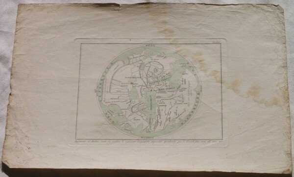
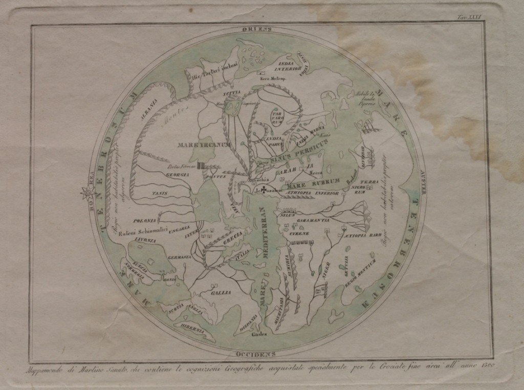
MAPPAMONDO DI MARTINO SANUTO CHE CONTIENE LE COGNIZIONI GEOGRAFICHE ACQUISTATE SPECIALMENTE PER LE CROCIATE SINO CIRCA ALL'ANNO 1300
Livres anciens et modernes

MAPPAMONDO DI MARTINO SANUTO CHE CONTIENE LE COGNIZIONI GEOGRAFICHE ACQUISTATE SPECIALMENTE PER LE CROCIATE SINO CIRCA ALL'ANNO 1300
Livres anciens et modernes
120,00 €
(Foligno,
Italie)
Mode de Paiement
- PayPal
- Carte bancaire
- Virement bancaire
- Pubblica amministrazione
- Carta del Docente
Détails
Description
Bella mappa acquarellata del 1840 circa che rappresenta la terra secondo Martino Sanuto in base alle conoscenze del 1300. In buone condizioni. DIMENSIONI FOGLIO: cm 45x29,5 DIMENSIONI INCISIONE: cm 25x19 EPOCA: 1840 circa CONDIZIONI: Buone, fioriture e lieve gora d'umidità all'angolo superiore destro. Very beautiful coloured map of around 1840 with aquarello representing the earth according to the ideas of Martino Sanuto based on knowledges of 1300. LEAF DIMENSION: 45x29,5 ENGRAVING DIMENSION: cm 25x19 DATE: 1840's CONDITIONS: Good. Foxings and little humidity stain in the upper right corner.