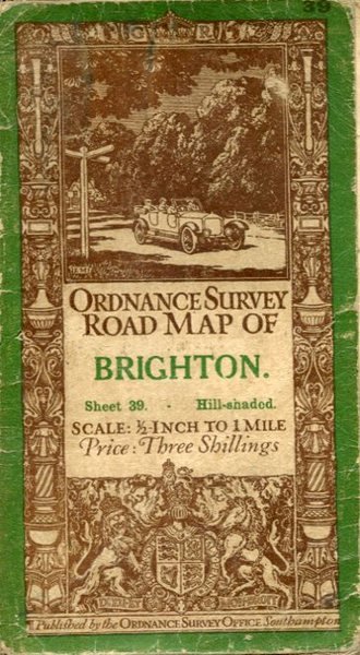
Ordnance Survey Road Map of Brighton :Linen-backed Sheet 39
Ordnance Survey Road Map of Brighton :Linen-backed Sheet 39 | Livres anciens et modernes | Ordnance Survey
Livres anciens et modernes
Ordnance Survey
Ordnance Survey,
1914
Ordnance Survey Road Map of Brighton :Linen-backed Sheet 39
Ordnance Survey Road Map of Brighton :Linen-backed Sheet 39 | Livres anciens et modernes | Ordnance Survey
Livres anciens et modernes
Ordnance Survey
Ordnance Survey,
1914
20,00 €
(Hyde,
Royaume-Uni)
Mode de Paiement
- PayPal
- Carte bancaire
- Virement bancaire
- Pubblica amministrazione
- Carta del Docente
Détails
- Année
- 1914
- Auteur
- Ordnance Survey
- Éditeurs
- Ordnance Survey
- Format
- 7 x 4 inches
- Thème
- Map, Brighton
- Description
- Soft Cover
- Jaquette
- False
- Etat de conservation
- En bonne condition
- Langues
- Anglais
- Reliure
- Couverture souple
- Dédicacée
- False
- Premiére Edition
- False
Description
Well used lightly tanned map with damp effect to rear only, no corresponding marks to actual map. No added marks or inscriptions. Not torn but well rubbed at all fold corners. 1pp. Hill-shaded half-inch to one mile Ordnance Survey map of Brighton and surrounding district published in 1914. Opens up to 21 x 30 inches. Extremely scarce.
