ADRICHEM Christian. Theatrum Terrae Sanctae et Biblicarum Historiarum cum tabulis geographicis aere expressis.
ADRICHEM Christian. Theatrum Terrae Sanctae et Biblicarum Historiarum cum tabulis geographicis aere expressis. | Livres anciens et modernes |
ADRICHEM Christian. Theatrum Terrae Sanctae et Biblicarum Historiarum cum tabulis geographicis aere expressis.
ADRICHEM Christian. Theatrum Terrae Sanctae et Biblicarum Historiarum cum tabulis geographicis aere expressis. | Livres anciens et modernes |
Mode de Paiement
- PayPal
- Carte bancaire
- Virement bancaire
- Pubblica amministrazione
- Carta del Docente
Détails
Description
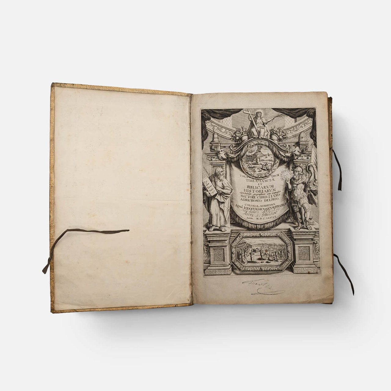
Coloniae Agrippinae (Cologne), apud Iodocum Henricum Kramer (Josse-Henri Kramer), 1682.
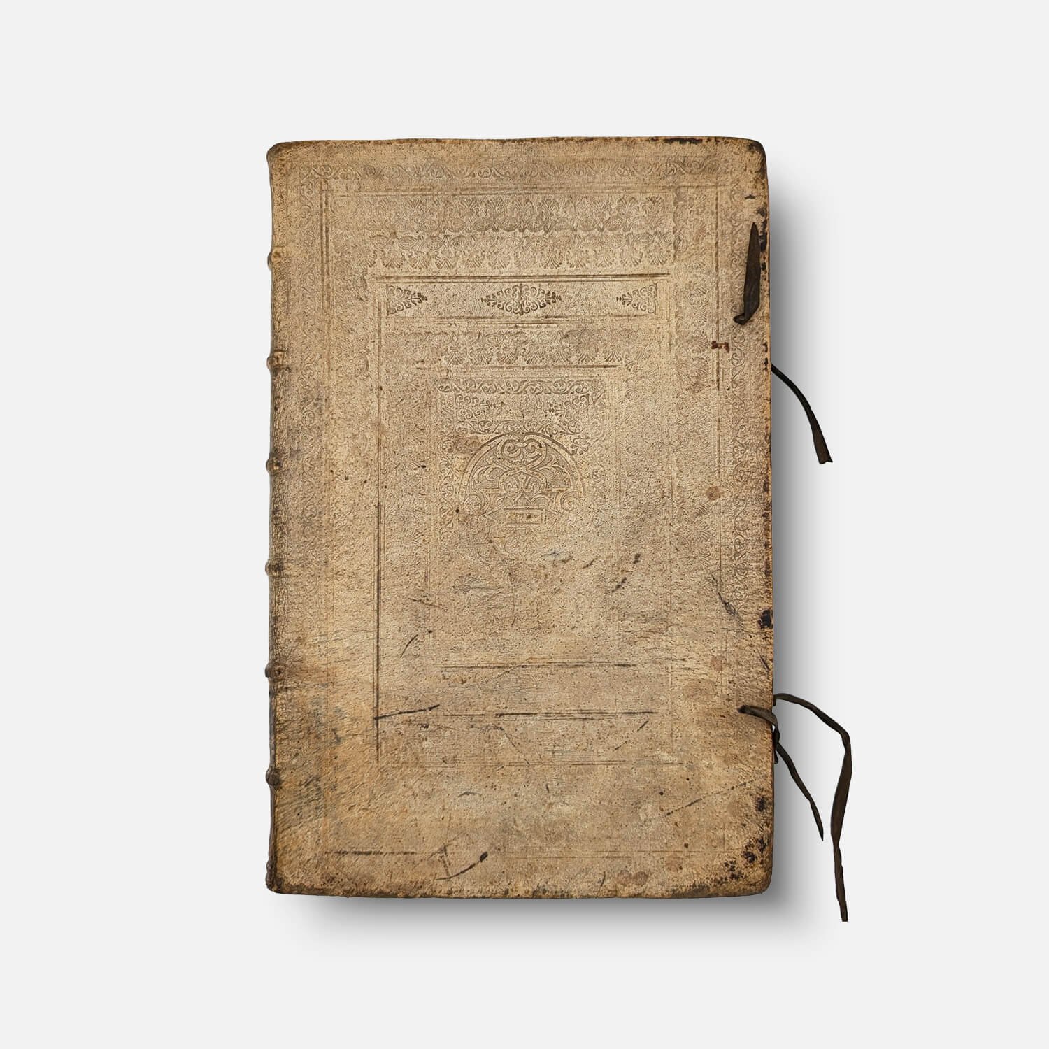
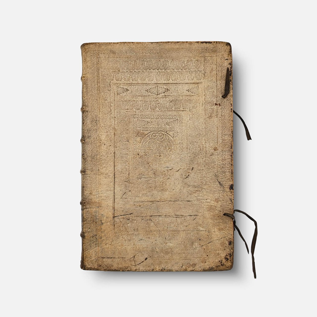
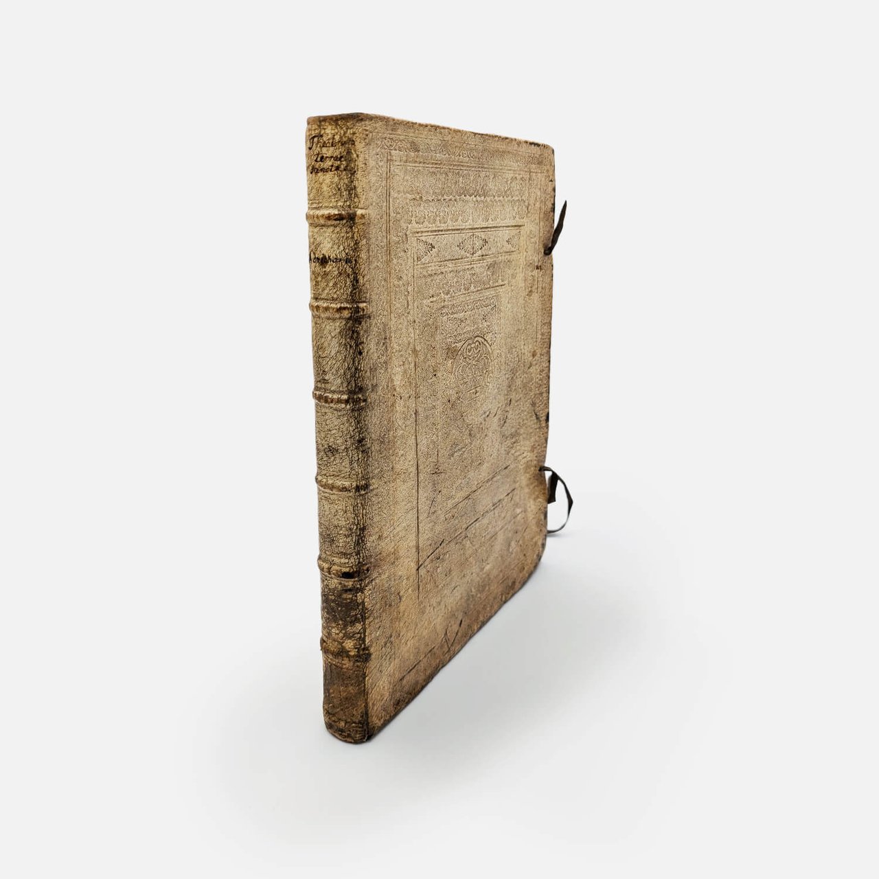
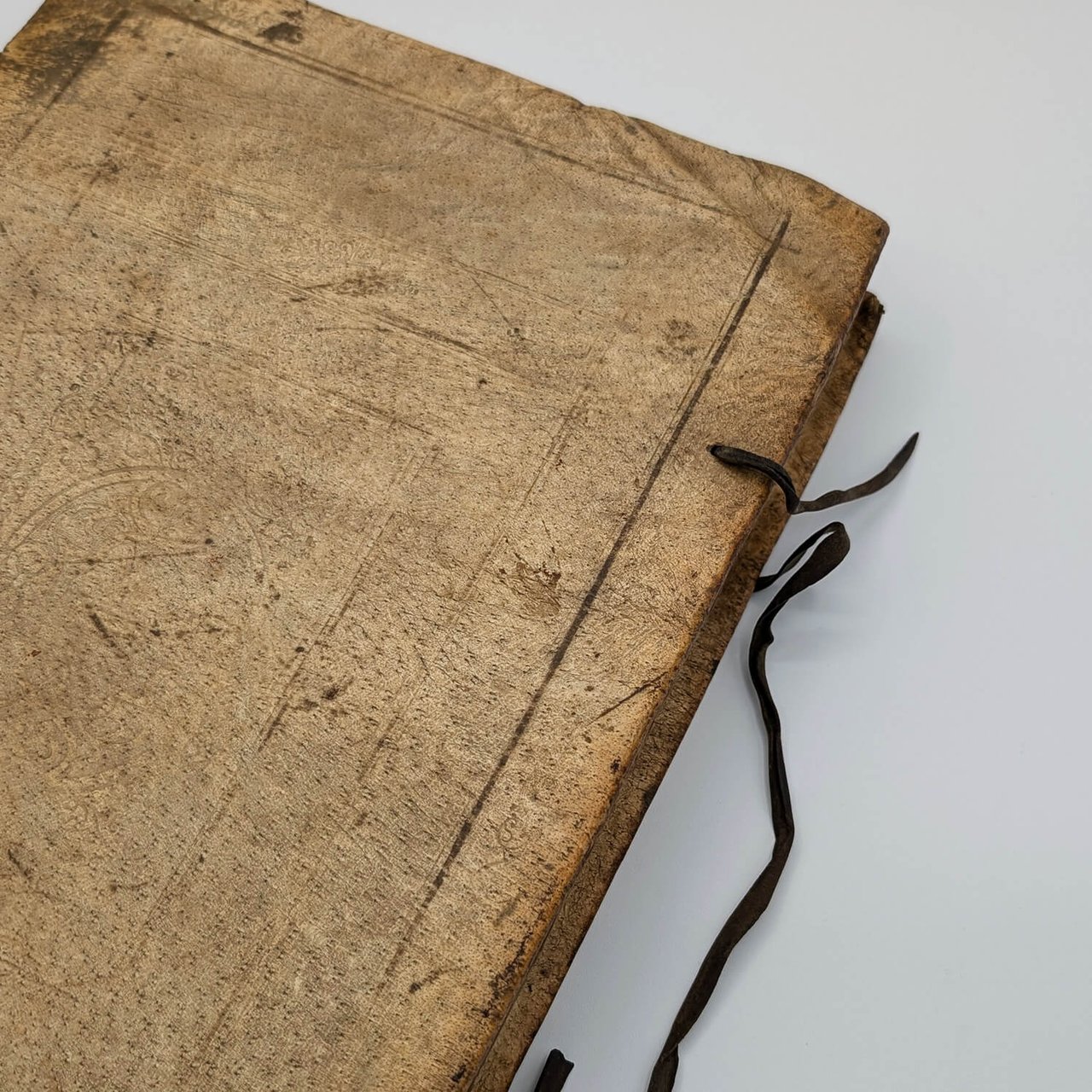
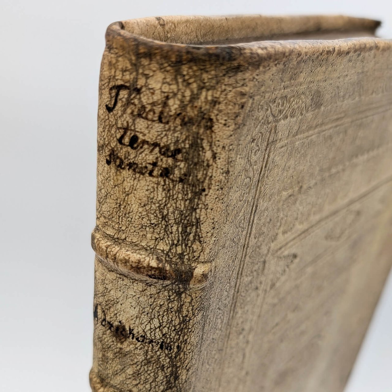
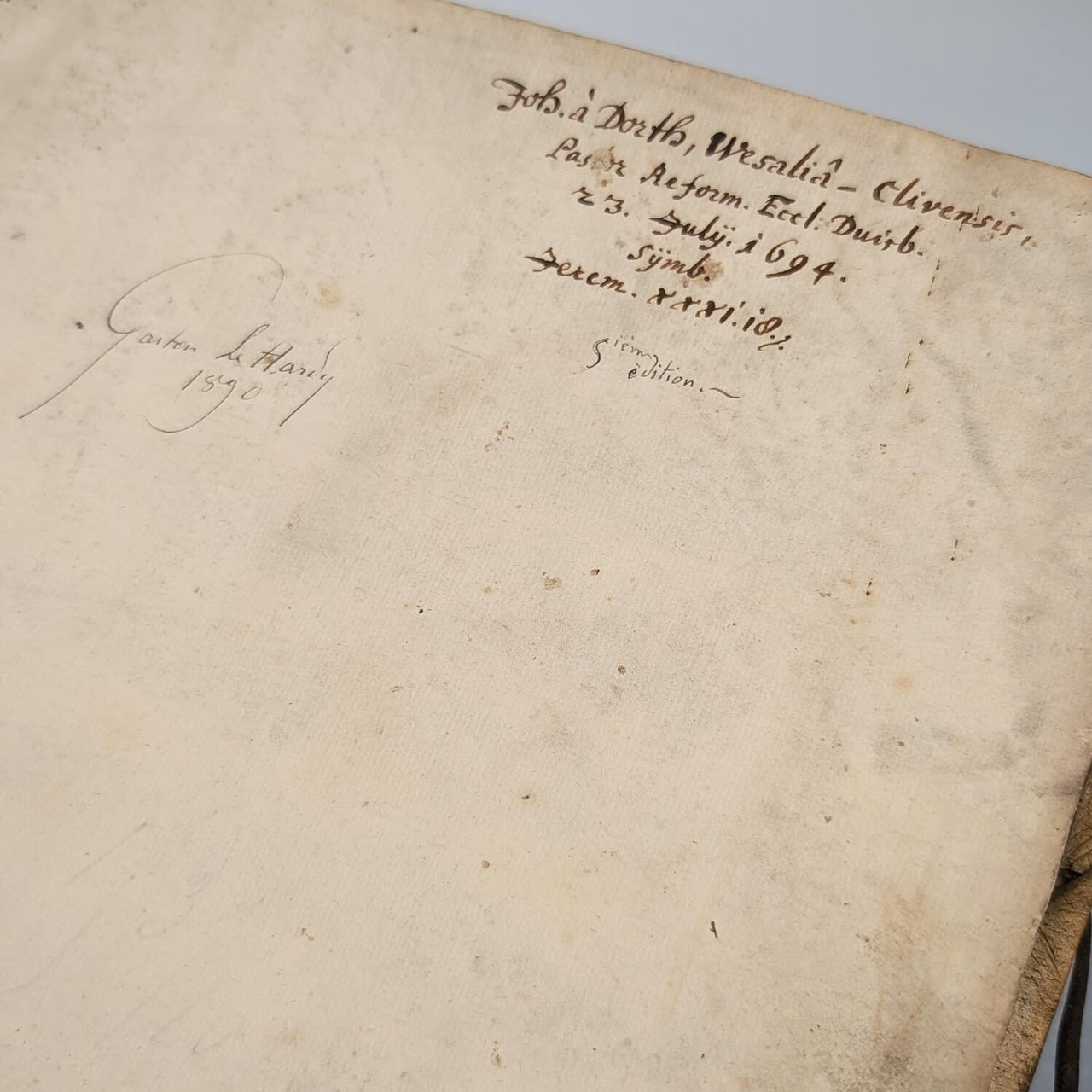
Magnificent and complete 1682 edition in contemporary blind-stamped ivory pigskin with its original ties. Purchased in Cologne (Emi Colonia Agrip.) and having belonged since 1694 to the Reformed pastor of Duisburg, Johannes à Dorth, who inscribed his biblical motto (Jeremiah 31:10: "Hear the word of the Lord, O nations, and declare it in the coastlands far away; say, ‘He who scattered Israel will gather him, and will keep him as a shepherd keeps his flock’") as well as to the illustrious historian of Palestine, Gaston Le Hardy (1890).
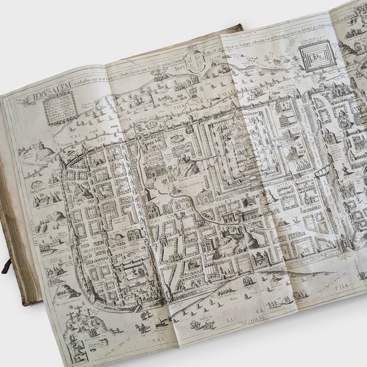
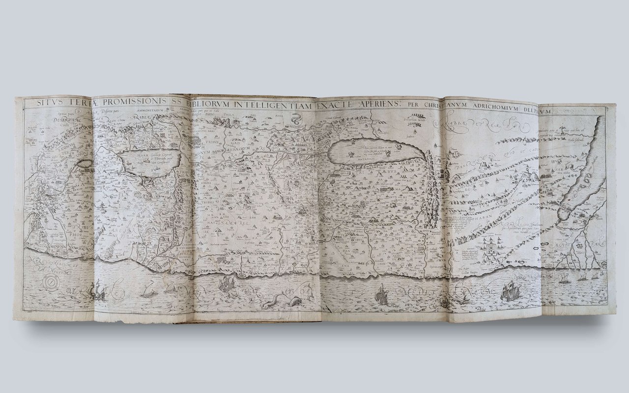
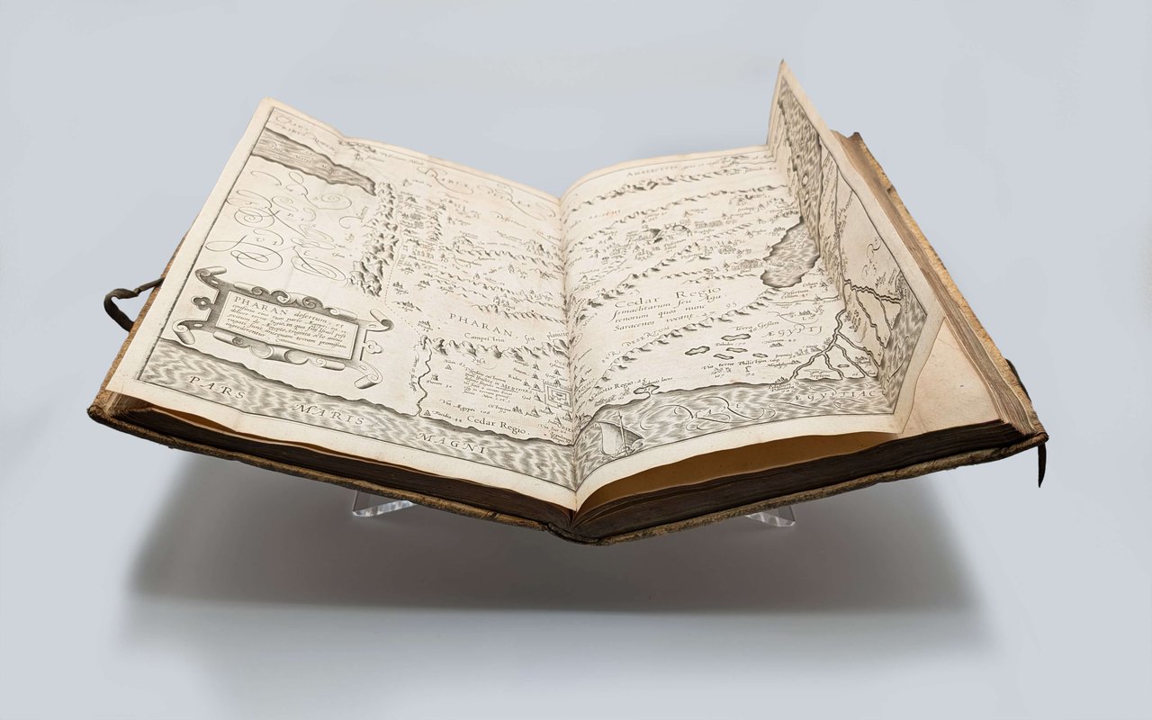
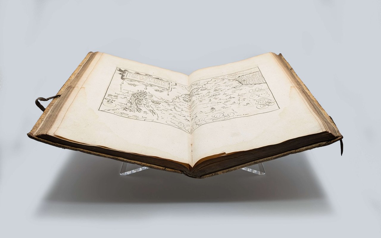
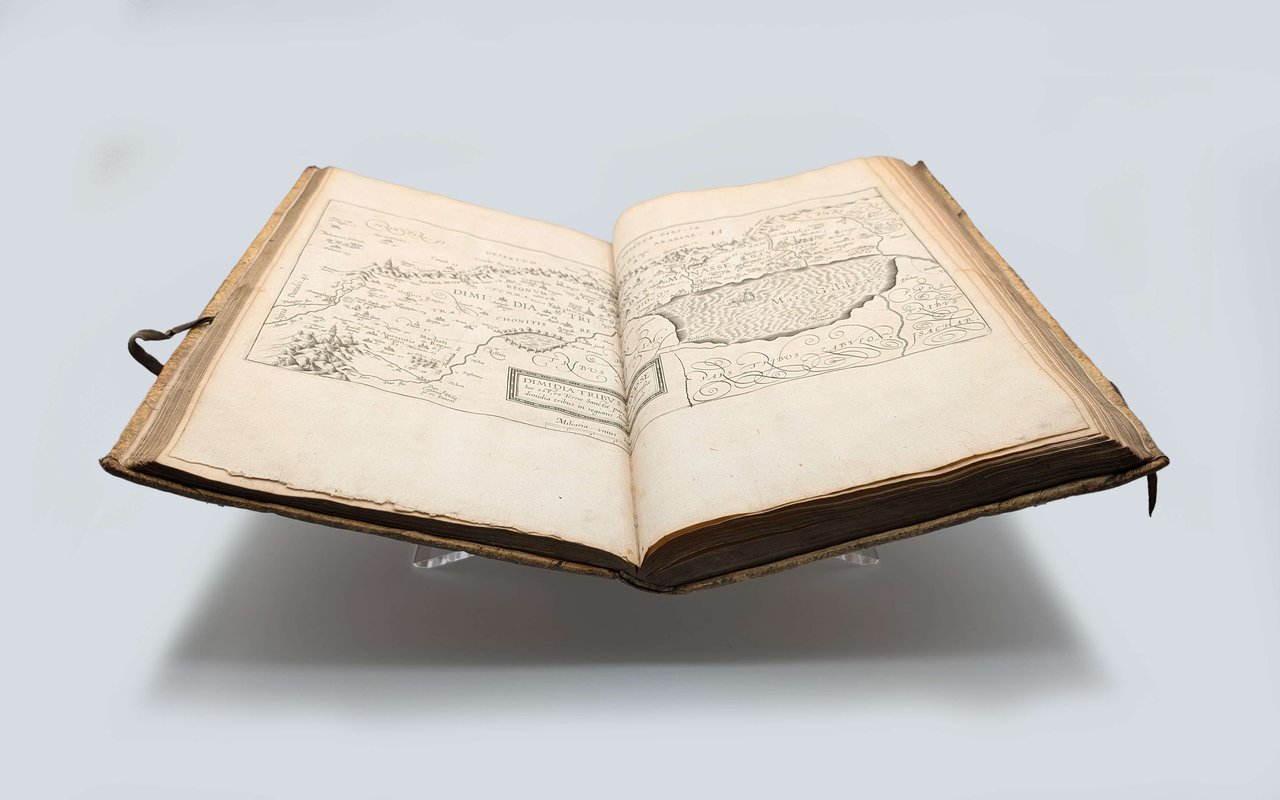
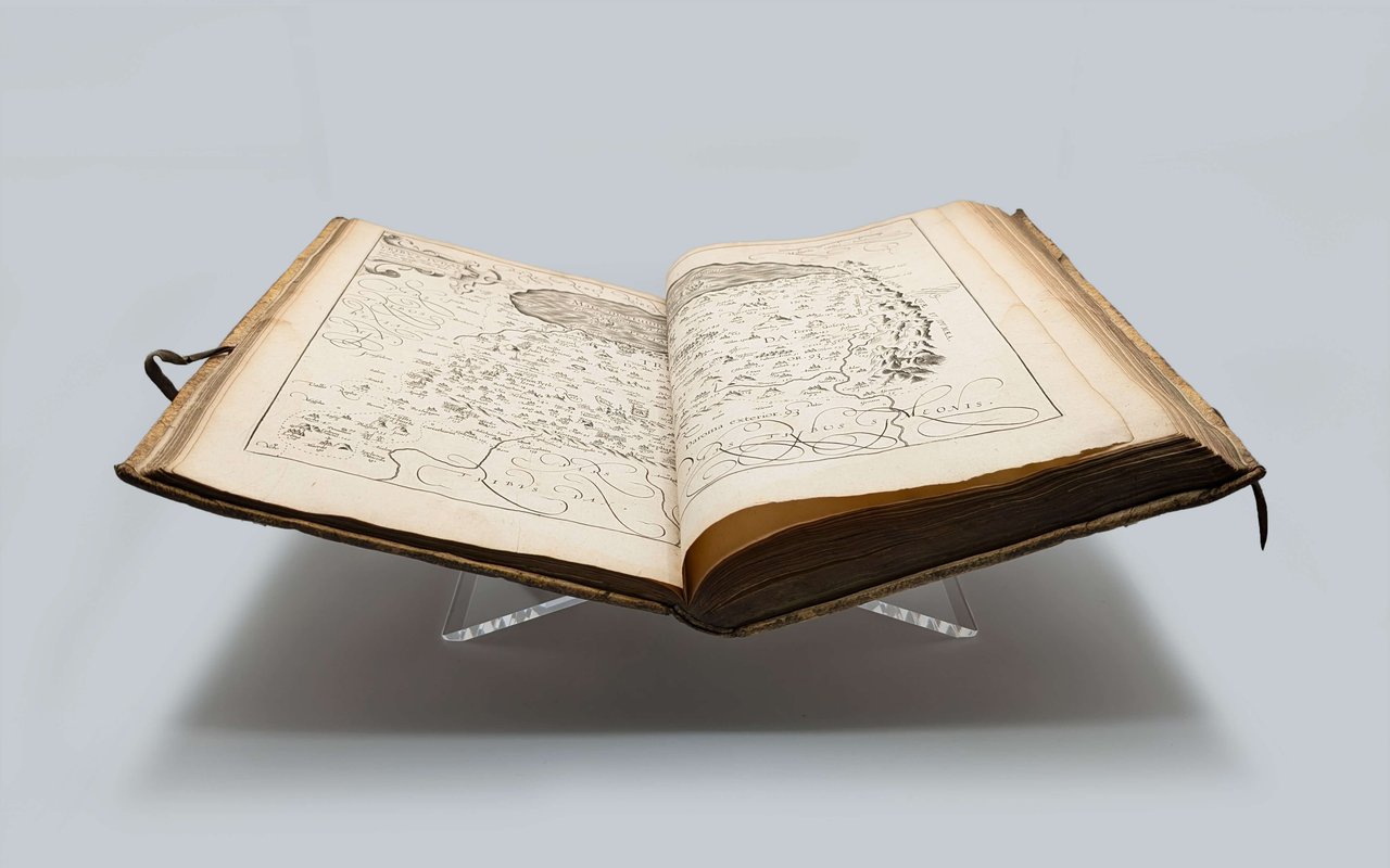
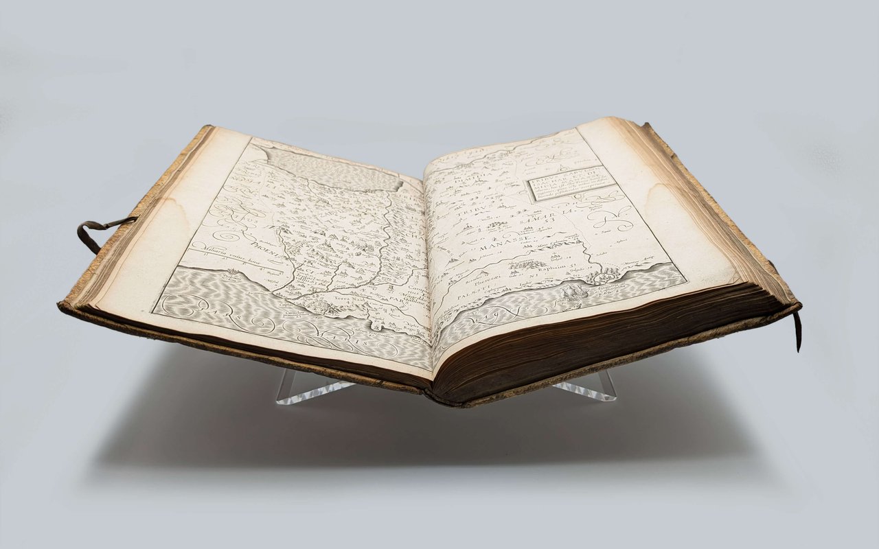
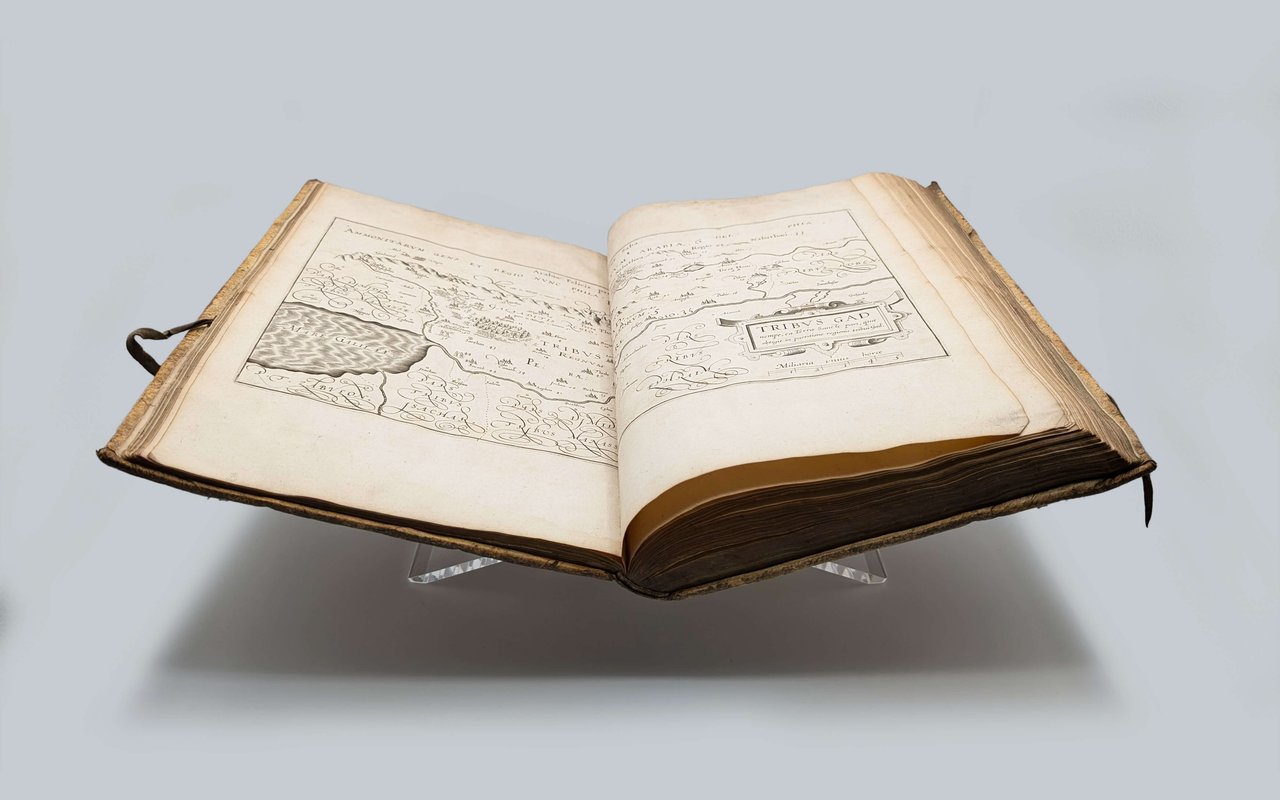
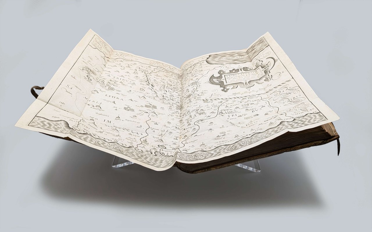
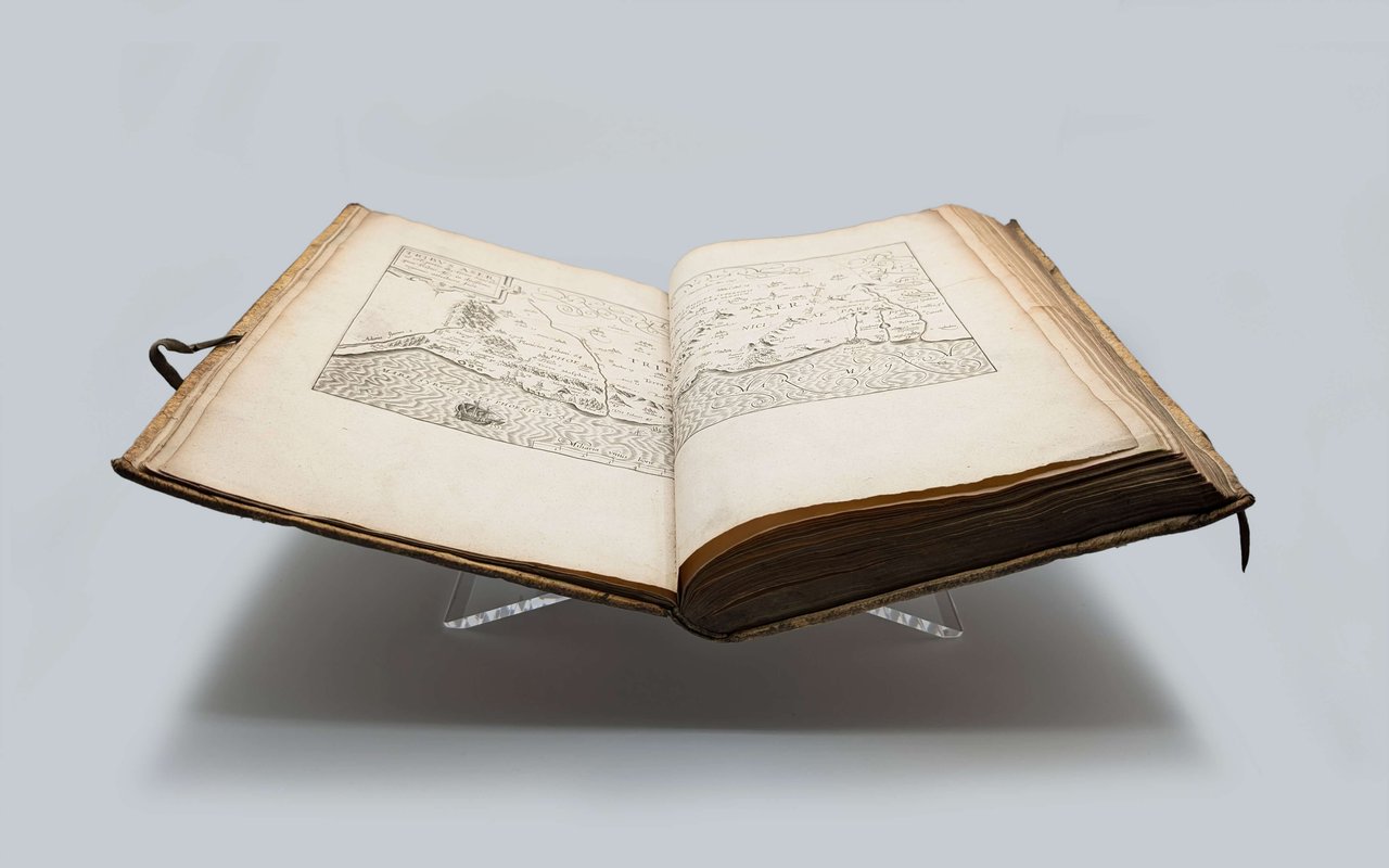
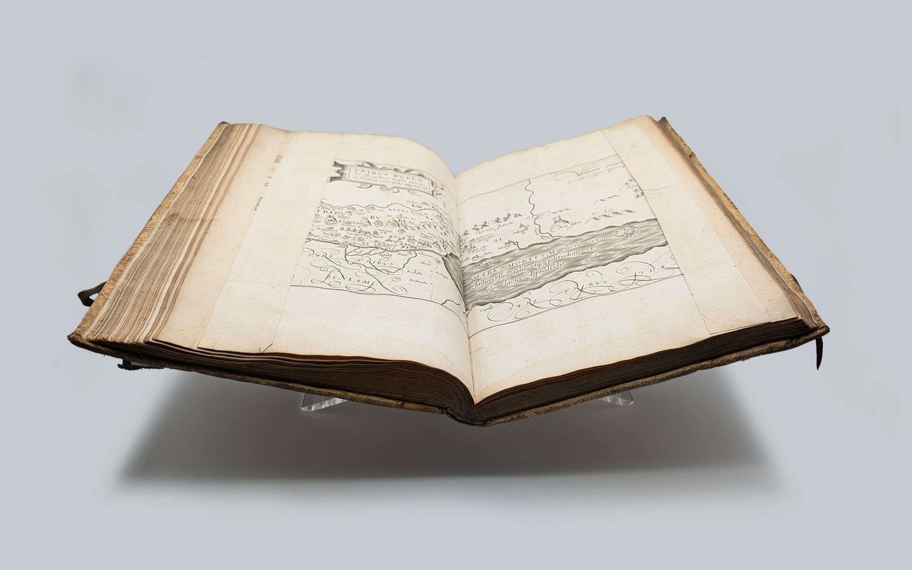
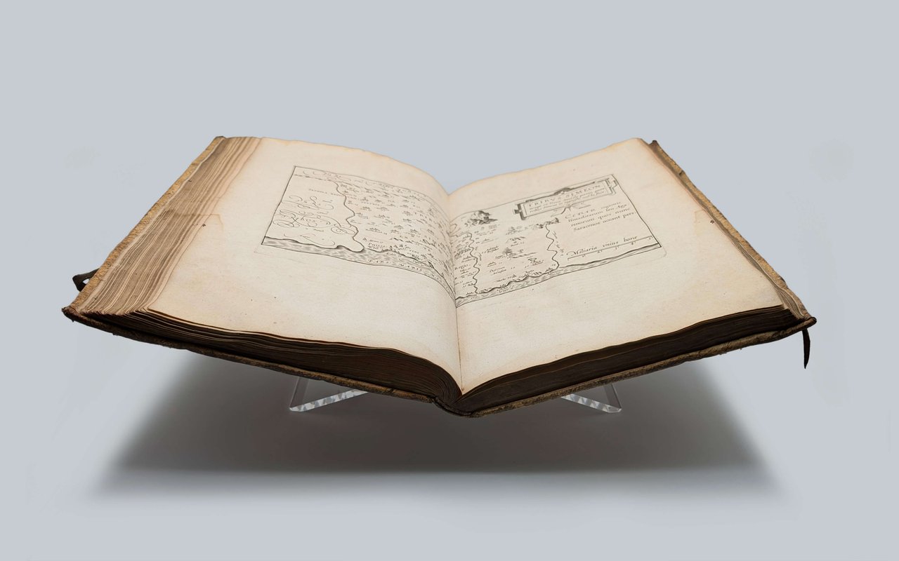
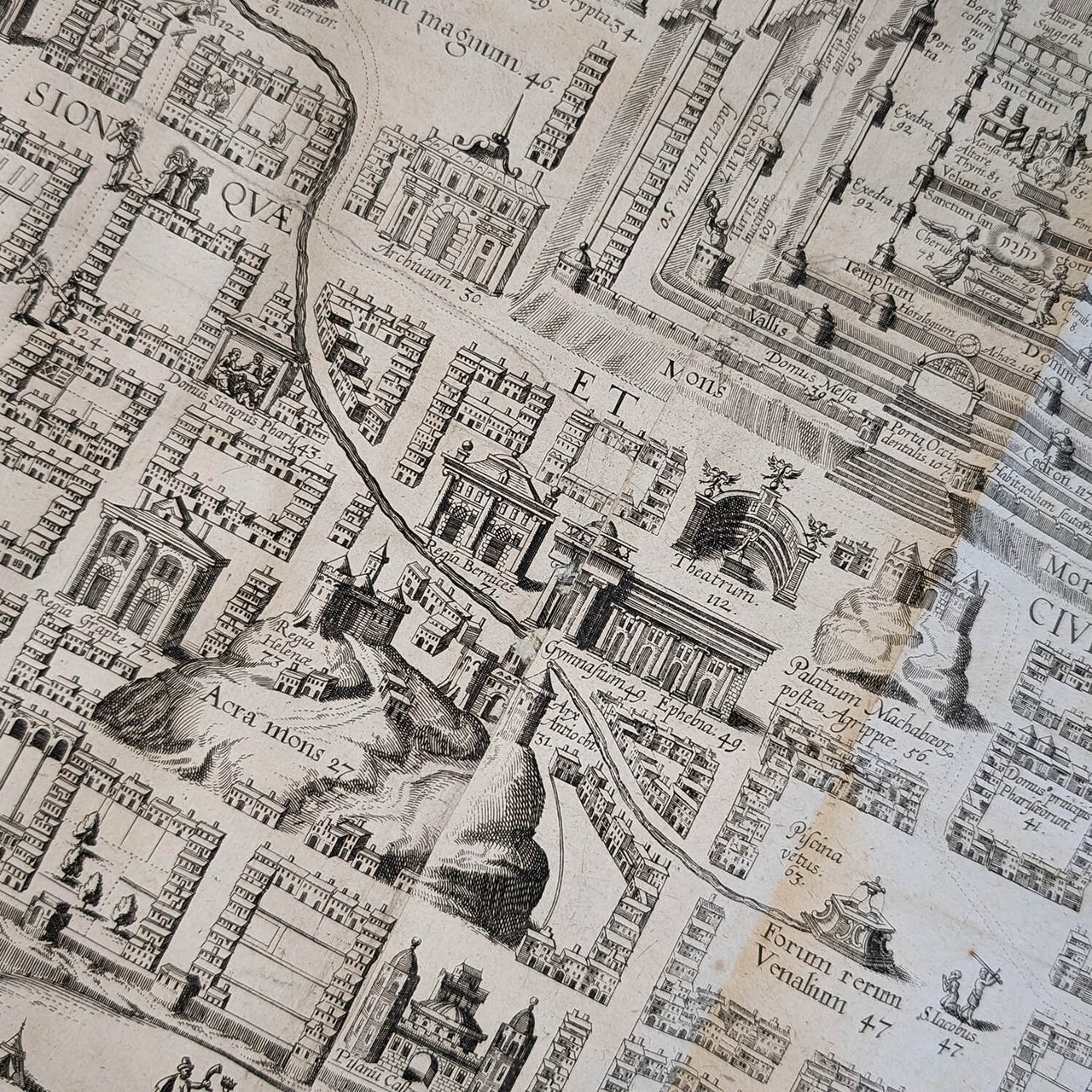
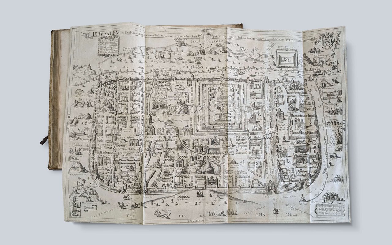
Richly illustrated with 12 double-page engraved maps, including a spectacular large folding general map of the Holy Land divided according to the territories of the twelve tribes of Israel, 9 maps of the tribal territories, a plate of the Exodus, and a large plan of Jerusalem. This extremely detailed plan offers a biblical and Christian interpretation of the city of Jerusalem. Measuring 75 x 52 cm, it remains a significant piece in the cartography of the Holy Land.
This edition is the work of the Cologne printer-bookseller Jodocus Henricus Kramer, successor to the famous Birckmannica workshop, the historical holder of the privileges and copperplates of Adrichom since the end of the 16th century. It stands out from previous editions by a superb frontispiece, a new typography, and finer, more detailed initial letters. Kramer produced here the last great early edition of Cologne using the original copperplates. (Laor, Maps of the Holy Land, 934).
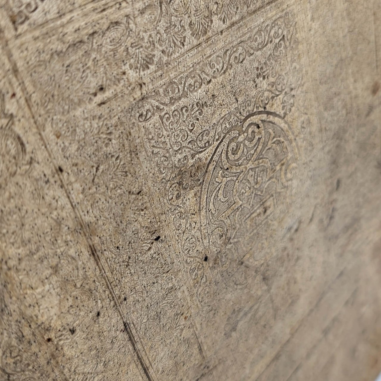
In-folio (38.5 x 25 cm); [1] blank f., engraved title frontispiece, [8] ff., 286 pp., [1] f. Catalogus Auctorum, [12] ff. Index, 1 blank f., 42 pp. Index of names. Text in Latin on 2 columns. Contemporary blind-stamped ivory pigskin with original ties, spine with raised bands and manuscript title. The work begins with the description of the Holy Land with the large map, followed by a description of each territory of the 12 tribes accompanied by mapping. Then comes the detailed plan of Jerusalem and the numbered detail of each building, followed by the Catalogus Auctorum and the Index. Originally published in Cologne in 1590, five years after the death of its author, the Theatrum Terrae Sanctae was reprinted in 1593, 1600, 1613, 1628, 1682, and 1722 (corrected edition of 1682). The first atlas dedicated to the Holy Land, it is Adrichem's most important and famous work.
The author, Christian Kruik van Adrichem, was a Catholic priest and director of the Convent of Saint Barbara, born in Delft, Netherlands, on February 13, 1533. The religious unrest of the Reformation forced him to move several times within the Netherlands before finally settling in Cologne. It was there that he turned to the study of the geography of the Holy Land. He died in that same city on June 20, 1585.
The title “Theatrum terrae sanctae et biblicarum historiarum cum tabulis geographicis” is a direct description of the book's structure, as well as its philosophy of geographical thought.
The “Theatrum” refers to early modern ideas on the organization and communication of knowledge. Placing it in the title shows that Adrichem advocates for a thoughtful and structured book on the historical geography of the Bible (1). “Terrae sanctae et biblicarum historiarum cum tabulis geographicis” brings us into the field of expertise of “Geographia Sacra,” designating the systematic study of biblical and ecclesiastical geography. This field of inquiry, whose components Eusebius of Caesarea enumerated in the preface to his Onomasticon, is not merely a technical cartographic “arrangement” between the Bible and geography, but an exegetical and interpretive act (2).
Theatrum terrae sanctae et biblicarum historiarum cum tabulis geographicis is therefore a scholarly work written in the 16th century by a Catholic priest in a difficult religious context. It aimed to be at the cutting edge of the knowledge of the time, resulting from a rigorous work of biblical study, traveler testimony, and cartography. But it is also the artistic culmination of an expertise in sacred geography.
It is interesting to note, paraphrasing Zur Shalev’s work on the fertility of the Holy Land, that while Adrichem must have drawn inspiration from testimonies to construct his Theatrum, even first-hand accounts were subject to a biblical prism. Travelers such as Burchard of Mount Sion (13th century), Leonhard Rauwolf (1570s), and Jean Zuallart (a Catholic pilgrim) expected to discover a Garden of Eden; when they saw the desert lands of Palestine, they either vigorously confirmed the fertility of the Holy Land or lamented it, claiming it had been reduced to arid deserts by God's punishment.
This reinforces the very Christian vision of the Theatrum without diminishing its geographical importance. “...the author (Adrichom) explored the metaphysical implications of pictorial realism in order to present and use his maps as Christian tools, equating the veracity of the cartographic medium with the authenticity of Christ’s life and the theological understanding of truth.” (3)
Adrichom's work was so precise and scholarly that it seems to have crossed denominational boundaries. The 1694 ex-libris of Johannes à Dorth, explicitly mentioning that he was a pastor of the Reformed church (Pastor Reform. Eccl. Duirb), is certainly no coincidence. This mention, annotated on a book written by a Catholic, not only highlights its importance for late 17th-century Protestant exegesis but also allows this knowledge to be intellectually associated with Reformed theology, in a context that was certainly still difficult after a century of conflict with the Spanish Catholics and in the midst of the War of the League of Augsburg and the revocation of the Edict of Nantes.
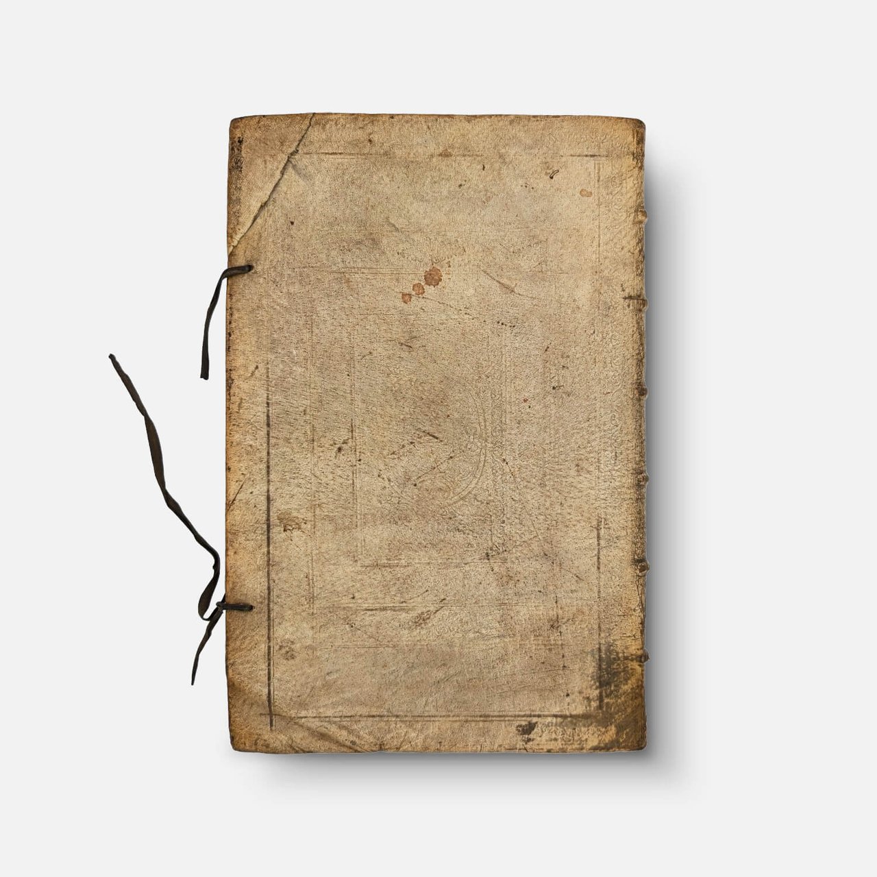
Condition: Binding soiled, rubbed in places, dampstaining on the cover and on inner pages. Leaf G3 bound before leaf G2, some pagination errors. All maps are in very good condition, without restoration. The large map of the Holy Land has a visible dampstain on the reverse. This book retains all its structural integrity. See detailed photos.
Sources & Bibliographic References
(1) A spectacular map theatre: The 1593 edition of Christiaan Adrichem’s Theatrum Terrae Sanctae, Dr. Marianne P. Ritsema van Eck. 2020.
(2) Zur Shalev, The Oxford Handbook of the Bible in Early Modern England, c. 1530-1700. 2015.
(3) Ioana Zamfir, Accuracy, veracity, and theological truth in the 16th century atlas Theatrum Terrae Sanctae. 2021 (National Museum of Maps and Old Books, Romania).
Graesse, I p.10.
Laor, Maps of the Holy Land, 934.
