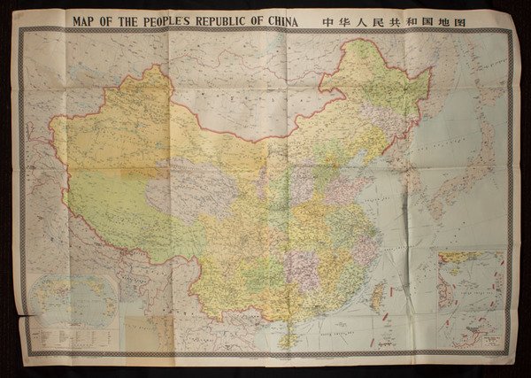
Map of the Peoples Republic of China. [Chinese Map with Inset of South China Sea Islands].
Map of the Peoples Republic of China. [Chinese Map with Inset of South China Sea Islands]. | Livres anciens et modernes |
Livres anciens et modernes
Cartographic Publishing House Beijing 1984.,
Map of the Peoples Republic of China. [Chinese Map with Inset of South China Sea Islands].
Map of the Peoples Republic of China. [Chinese Map with Inset of South China Sea Islands]. | Livres anciens et modernes |
Livres anciens et modernes
Cartographic Publishing House Beijing 1984.,
30,00 €
(Roma,
Italie)
Mode de Paiement
- PayPal
- Carte bancaire
- Virement bancaire
- Pubblica amministrazione
- Carta del Docente
Détails
- Éditeurs
- Cartographic Publishing House Beijing 1984.
- Thème
- CINA China Chine
- Jaquette
- False
- Etat de conservation
- En bonne condition
- Dédicacée
- False
- Premiére Edition
- False
Description
Large colour folding map of China, 114.5 x 162cm. Features inset maps of South China Sea Islands and a world map showing China's Geographic Location at lower corners. Scale 1:4000,000. Text in Pinyin, English and Chinese characters. Shows administrative regions correct to December 1983; boundaries, water features, capitals, towns, villages, shipping and other transport routes.
