Ordnance Survey Contoured Road Map of Newquay. Popular Edition. One Inch, Sheet 143. [Ellis Martin cover].
Ordnance Survey Contoured Road Map of Newquay. Popular Edition. One Inch, Sheet 143. [Ellis Martin cover]. | Livres anciens et modernes | Ordnance Survey
Livres anciens et modernes
Ordnance Survey
Ordnance Survey, [Southampton,
1931
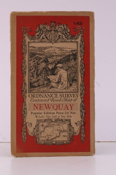
25,30 €
(Devon,
Royaume-Uni)
Mode de Paiement
- PayPal
- Carte bancaire
- Virement bancaire
- Pubblica amministrazione
- Carta del Docente
Détails
- Année
- 1931
- Auteur
- Ordnance Survey
- Éditeurs
- Ordnance Survey, [Southampton
- Thème
- topography, newquay, os, ordnance survey, maps, ordnance survey, topography, maps, ordnance, survey, contoured, road, map, newquay
- Langues
- Anglais
Description
Folding coloured map on cloth measuring 21.x 28.5 ins (approx. 53.0 x 72.0 cms) folding in 24 panels to 7.0 x 3.5 ins (approx. 18.0 x 9.0 cms); original pictorial card wrappers a very good bright clean copy. The famous Popular Edition One Inch series was first published in 1919 with striking 'cyclist' artwork by Ellis Martin. The present copy is the 1931 reissue; the covers are black with red sheet name and location map. Browne, 11.1.a
