A chart of the south part of Cephalonia, with the Islands of Zante and the coast of Morea from C. Chiarese to C. Sapienza; A chart of the south coast of Morea .
A chart of the south part of Cephalonia, with the Islands of Zante and the coast of Morea from C. Chiarese to C. Sapienza; A chart of the south coast of Morea . | Gravures | THORNTON SAMUEL
Gravures
THORNTON SAMUEL
1702-1706
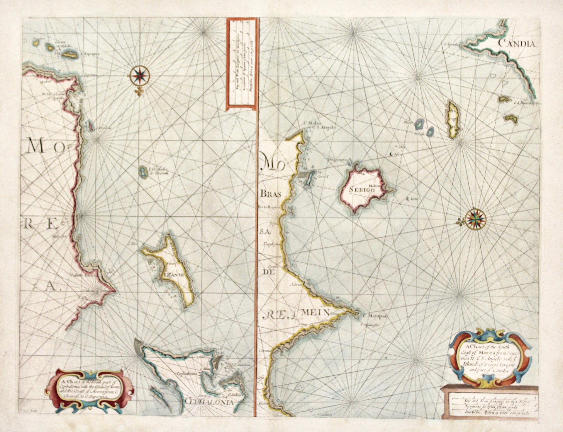
590,00 €
(Verona,
Italie)
Mode de Paiement
- PayPal
- Carte bancaire
- Virement bancaire
- Pubblica amministrazione
- Carta del Docente
Détails
- Année
- 1702-1706
- Lieu d'édition
- Londra
- Graveurs
- THORNTON SAMUEL
- Thème
- Cefalonia Zante
Description
Incisione in rame, dipinta a mano, mm 402x523. Coppia di carte nautiche su un foglio; a sinistra Zante, Morea e il settentrione di Cefalonia; a destra Morea, Cerigo e parte di Creta. Da Thornton “The English Pilot Part III….the Whole Mediterranean Sea” pubblicato da Mount & Page. Buone condizioni generali eccetto una mancanza restaurata al margine inferiore che non intacca l'inciso. Sabin 95631; and Phillips 2833, 3455.
