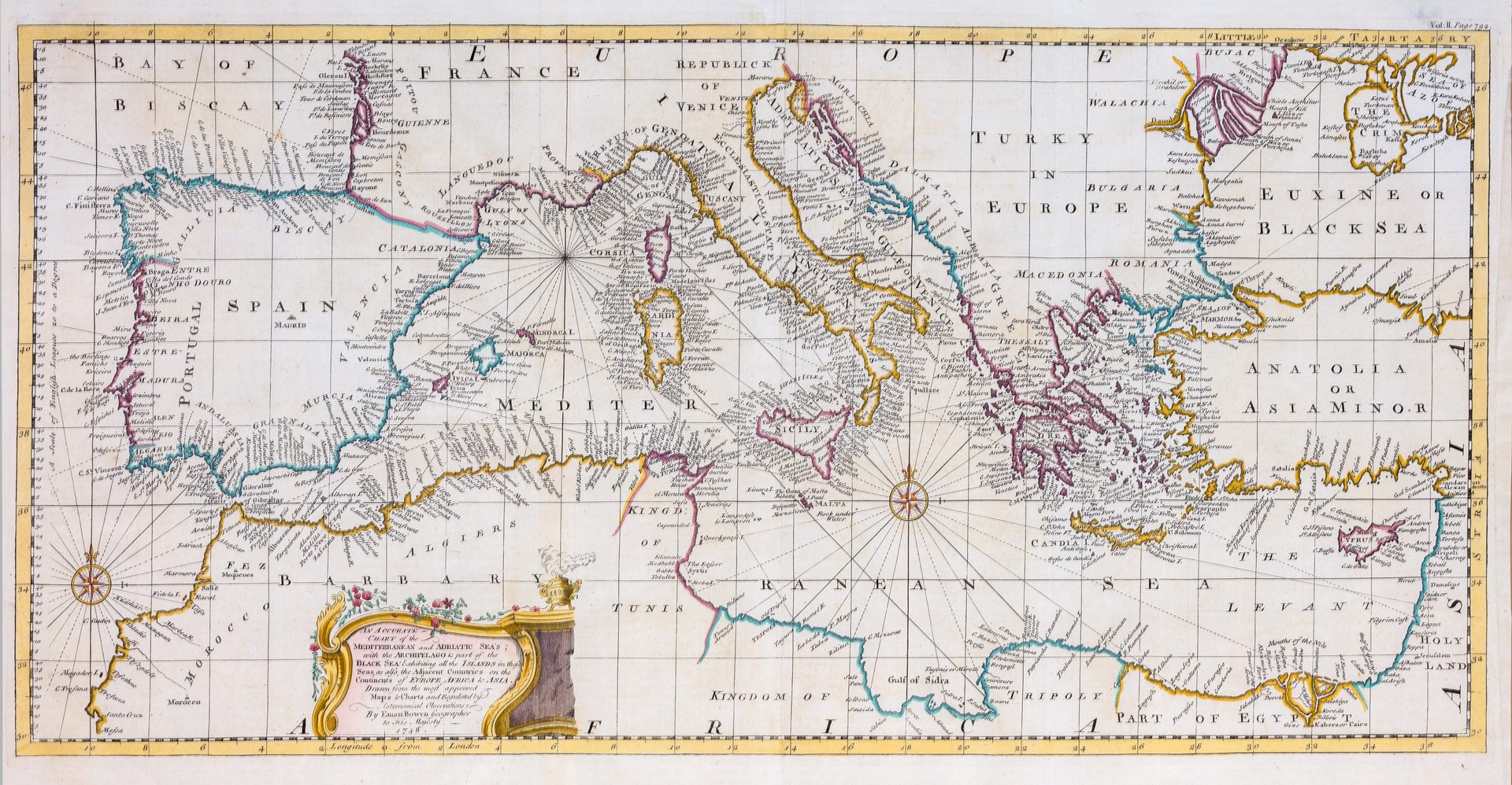
An accurate chart of the Mediterranean and Adriatic sea with the Arcipelago and part of the Black sea
An accurate chart of the Mediterranean and Adriatic sea with the Arcipelago and part of the Black sea | Gravures | BOWEN EMMANUEL
An accurate chart of the Mediterranean and Adriatic sea with the Arcipelago and part of the Black sea
An accurate chart of the Mediterranean and Adriatic sea with the Arcipelago and part of the Black sea | Gravures | BOWEN EMMANUEL
Mode de Paiement
- PayPal
- Carte bancaire
- Virement bancaire
- Pubblica amministrazione
- Carta del Docente
Détails
- Année
- 1748
- Lieu d'édition
- Londra
- Graveurs
- BOWEN EMMANUEL
- Thème
- mediterraneo e adriatico
Description
Mm 285x585, dipinta a mano. Emanuel Bowen (1694?-1767) è stato un incisore e venditore di stampe britannico. Era noto soprattutto per i suoi atlanti e le sue mappe delle contee. Sebbene sia morto in povertà, la sua competenza era ampiamente riconosciuta e fu nominato cartografo sia da Giorgio II d'Inghilterra che da Luigi XV di Francia. La sua attività fu portata avanti dal figlio Thomas Bowen. Formò anche molti apprendisti, due dei quali divennero cartografi di spicco, Thomas Kitchin e Thomas Jeffreys.<BR>Emanuel Bowen (1694?-1767) was a British engraver and print seller. He was most well-known for his atlases and county maps. Although he died in poverty, he was widely acknowledged for his expertise and was appointed as mapmaker to both George II of England and Louis XV of France. His business was carried on by his son, Thomas Bowen. He also trained many apprentices, two of whom became prominent mapmakers, Thomas Kitchin and Thomas Jeffreys. <BR>
