Anchorages in Ysabel Island
Anchorages in Ysabel Island | Gravures | Admiralty Charts, Admiralty Charts
Gravures
Admiralty Charts, Admiralty Charts
Anchorages in Ysabel Island
Anchorages in Ysabel Island | Gravures | Admiralty Charts, Admiralty Charts
Gravures
Admiralty Charts, Admiralty Charts
60,00 €
(Gavirate,
Italie)
Mode de Paiement
- PayPal
- Carte bancaire
- Virement bancaire
- Pubblica amministrazione
- Carta del Docente
Détails
- Format
- mm 628x483
- Edition
- '900
- Graveurs
- Admiralty Charts
- Thème
- Ysabel Island - Salomon islands - Pacific Ocean
- Designers
- Admiralty Charts
- Langues
- Italien
Description
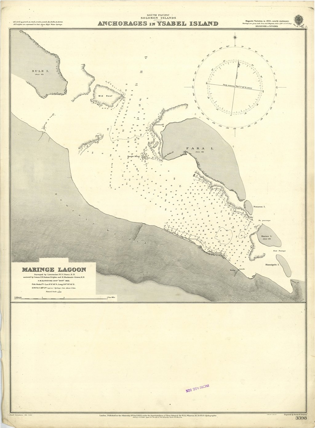
Anchorages in Ysabel Island. In the upper part of the chart insert of Maringe Lagoon Surveyed by Lieutenant F.C.C. Pasco, assisted by Lieuts. C.E. Stainer, R. Aylen and K. Mackenzie-Grieve, H.M. Surveying Ship "Dart" 1902. London Published at the Admiralty, 21st Nov. 1903, under the Superintendence of Rear Admiral Sir W.J.L. Wharton, Hydrographer. Small corrections: 1920. Autore: Admiralty Charts. Luogo: Ysabel Island - Salomon islands - Pacific Ocean. Anno: '900. Tecnica: incisione. Dimensioni: 628x483 mm
Anno di pubblicazione: '900
