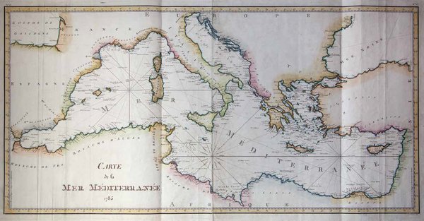
Carte de la Mer Mèditerranée 1785
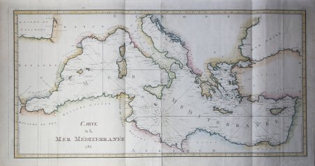
Carte de la Mer Mèditerranée 1785
Mode de Paiement
- PayPal
- Carte bancaire
- Virement bancaire
- Pubblica amministrazione
- Carta del Docente
Détails
- Année
- 1785
- Lieu d'édition
- Parigi
- Format
- 1070 X 545
- Graveurs
- Dépôt des cartes et plans de la Marine
- Description
- S. Bifolco, "Mare Nostrum, Cartografia nautica a stampa del Mar Mediterraneo" (2020), pp. 284-285, tav. 134.
Description
Acquaforte, stampata su due fogli, dimensioni totali 545x1070. Firmata in lastra nell’angolo in basso a destra con il nome dell’incisore L. A. Dupuis Sculp. Bell'esemplare, finemente colorato a mano.Opera tratta da: Hydrographie Françoise recueil des cartes générales et particulieres qui ont êté faites pour le service des vaisseaux du Roy.Carta nautica del Mediterraneo stampata per ordine di Joseph Bernard de Chabert, dal Dépôt des cartes et plans de la Marine, incisa da Louis André Dupuis nel 1785. Joseph Bernard, marchese di Chabert de Cogolin (Tolone 1724-1805), era un ufficiale di marina, geografo ed astronomo, direttore del Dépôt des cartes et plans de la Marine dal 1776 al 1792. La tavola è parte della celebre Hydrographie Françoise, il più importante atlante nautico del ’700 - iniziata per volontà di Jacques-Nicola Bellin - e stampata sotto la direzione del Dépôt des cartes et plans de la Marine.Bibliografia: cfr. O. Chapuis, A la mer comme au ciel: Beautemps-Beaupré & la naissance de lhydrographie, Parigi, 1999, pp. 151-4; cfr. National Maritime Museum, Catalogue of the Library - Vol. Three, Atlas & Cartography, Londra, 1971, pp. 306, n. 254 VI (176-178). Etching, printed on two sheets. Signed on the plate in the lower right corner by the name of the engraver L. A. Dupuis Sculp.Beautiful example, finely colored by hand.Taken from: Hydrographie Françoise compiles general and particular maps that have been made for the service of the Roy's vessels.The chart is printed by order of Joseph Bernard de Chabert, from the Depot of maps and plans of the Marine, engraved by Louis André Dupuis in 1785. Joseph Bernard, Marquis of Chabert de Cogolin (Toulon 1724-1805), was an officer of navy, geographer and astronomer, director of the Depot des cartes et plans de la Marine from 1776 to 1792. The chart is part of the famous Hydrographie Françoise, the most important nautical Atlas of the '700 - started at the will of Jacques-Nicola Bellin - and printed under the direction of the Depot of Maps and Marine Plans.Bibliografia: cfr. O. Chapuis, A la mer comme au ciel: Beautemps-Beaupré & la naissance de lhydrographie, Parigi, 1999, pp. 151-4; cfr. National Maritime Museum, Catalogue of the Library - Vol. Three, Atlas & Cartography, Londra, 1971, pp. 306, n. 254 VI (176-178). Cfr. S. Bifolco, "Mare Nostrum, Cartografia nautica a stampa del Mar Mediterraneo" (2020), pp. 284-285, tav. 134.