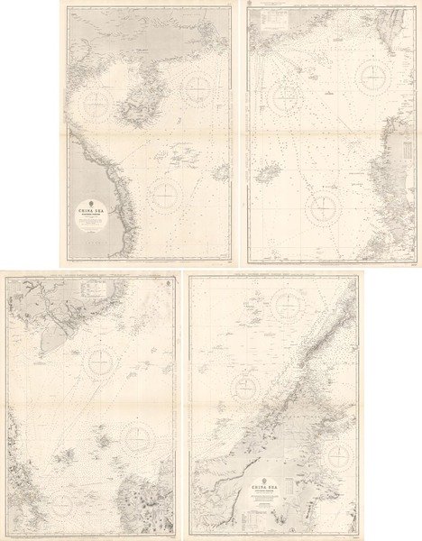
China Sea Northern Portion and Southern Portion
China Sea Northern Portion and Southern Portion | Gravures | Admiralty Charts, British Admiralty
Gravures
Admiralty Charts, British Admiralty
1930

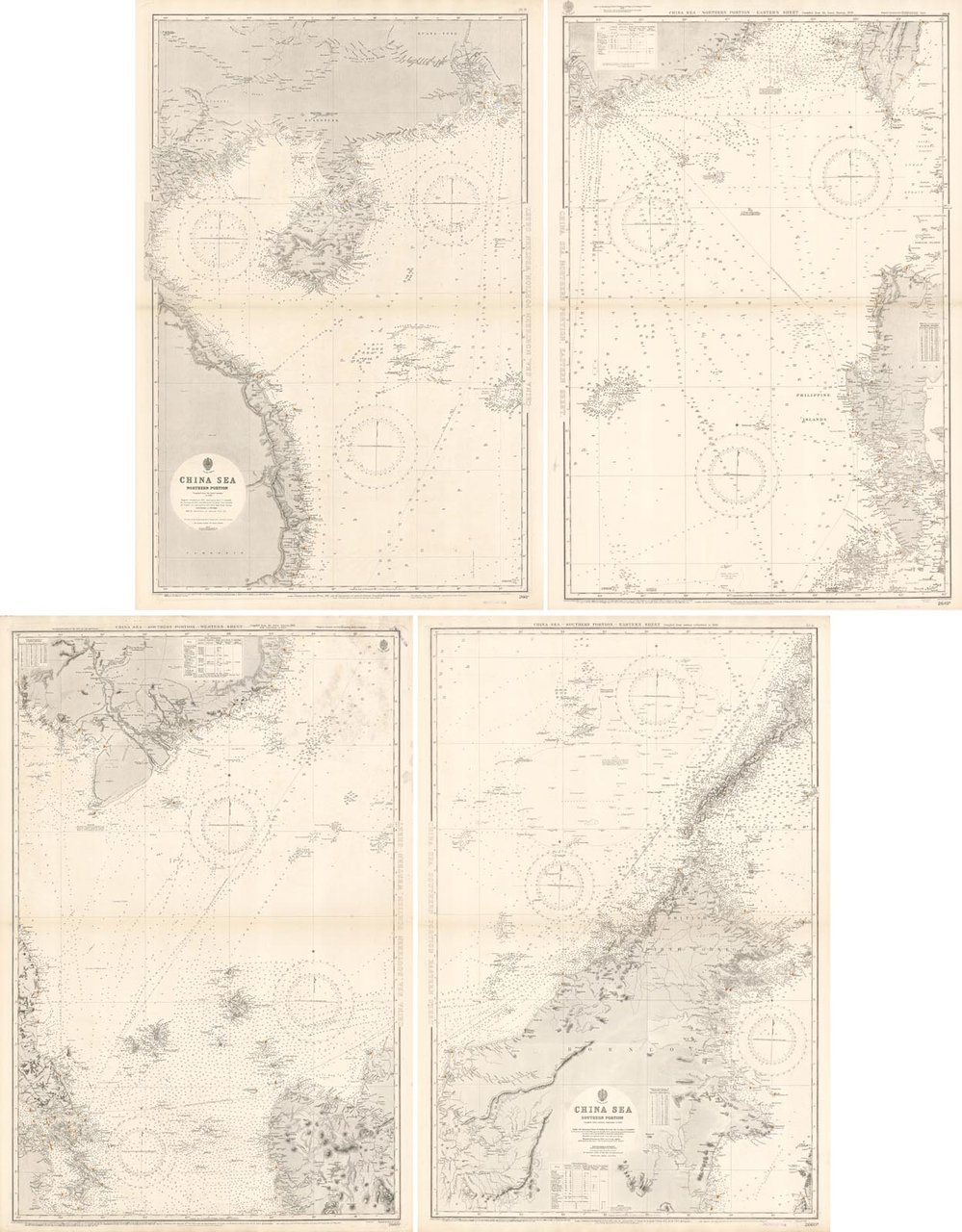
China Sea Northern Portion and Southern Portion
China Sea Northern Portion and Southern Portion | Gravures | Admiralty Charts, British Admiralty
Gravures
Admiralty Charts, British Admiralty
1930
1700,00 €
(Gavirate,
Italie)
Mode de Paiement
- PayPal
- Carte bancaire
- Virement bancaire
- Pubblica amministrazione
- Carta del Docente
Détails
- Année
- 1930
- Format
- mm 1693x1322 mm (ca)
- Edition
- 1930 ca
- Graveurs
- British Admiralty
- Thème
- Cina - China sea
- Designers
- Admiralty Charts
- Langues
- Italien
Description
Set of four unjoined nautical maps representing China Sea. Two sheets for the Southern Portion and other two for the Northern Portion:1- China Sea Southern Portion compiled from various authorities to 1923, published at the Admiralty 1 November 1881 under the Superintendence of Captain Sir Frederick J. Evans, with small corrections to 19312- China Sea Northern Portion compiled from the latest surveys to 1884, published at the Admiralty 18 September 1882 under the Superintendence of Captain Sir Frederick J. Evans, with small corrections to 1931
