Gravures
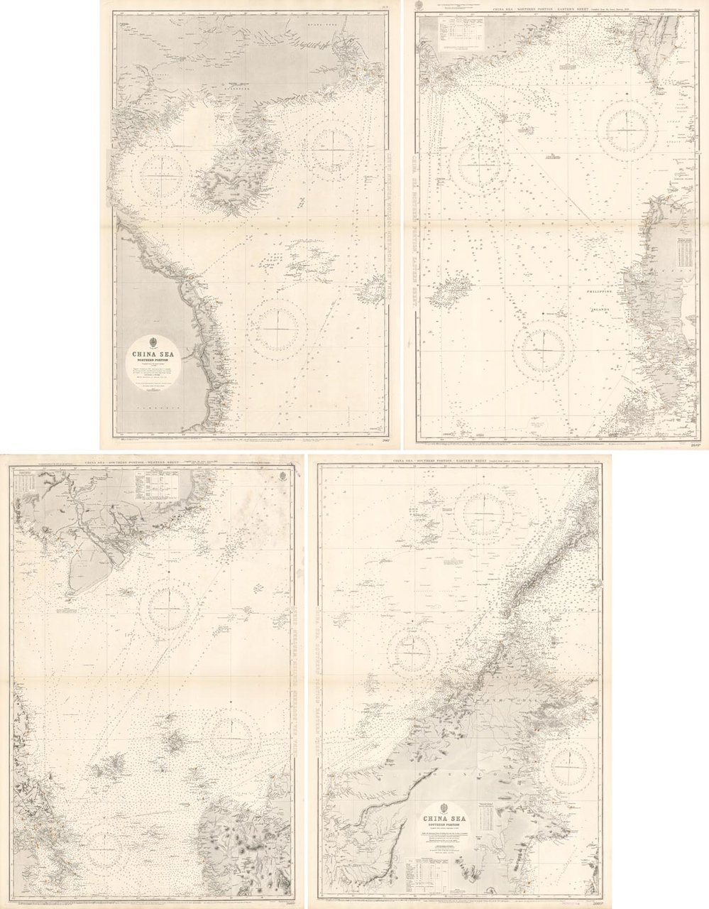
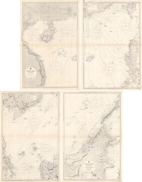
Admiralty Charts, British Admiralty
China Sea Northern Portion and Southern Portion
1930
1700,00 €
Trippini Sergio Libreria
(Gavirate, Italie)
Les frais d'expédition corrects sont calculés une fois que l'adresse de livraison a été indiquée lors de la création de la commande. Un ou plusieurs modes de livraison sont disponibles à la discrétion du vendeur : standard, express, economy, in store pick-up.
Conditions d'expédition de la Librairie:
Pour les articles dont le prix est supérieur à 300 euros, il est possible de demander un plan de paiement échelonné à Maremagnum. Le paiement peut être effectué avec Carta del Docente, Carta della cultura giovani e del merito, Public Administration.
Les délais de livraison sont estimés en fonction du temps d'expédition de la librairie et de la livraison par le transporteur. En cas de retenue douanière, des retards de livraison peuvent survenir. Les frais de douane éventuels sont à la charge du destinataire.
Pour plus d'informationsMode de Paiement
- PayPal
- Carte bancaire
- Virement bancaire
-

-
 Découvrez comment utiliser
votre Carta del Docente -
 Découvrez comment utiliser
votre Carta della cultura giovani e del merito