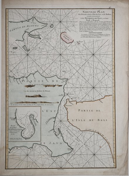
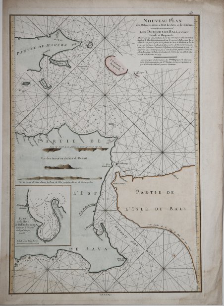
Nouveau Plan des Détroits, situés a l'Est de Java et de Mandura…
Gravures
DE MANNEVILLETTE Jean Baptiste Nicolas Denis d'APRES
1775
Nouveau Plan des Détroits, situés a l'Est de Java et de Mandura…
Gravures
DE MANNEVILLETTE Jean Baptiste Nicolas Denis d'APRES
1775
325,00 €
(Roma,
Italie)
Mode de Paiement
- PayPal
- Carte bancaire
- Virement bancaire
- Pubblica amministrazione
- Carta del Docente
Détails
- Année
- 1775
- Lieu d'édition
- Parigi
- Format
- 340 X 510
- Graveurs
- DE MANNEVILLETTE Jean Baptiste Nicolas Denis d'APRES
Description
Mappa francese dello stretto di Bali. Include parte di Giava, di Madura e la punta occidentale di Bali, con un inserto grafico del porto di Ballembouang. La carta si basa sui viaggi del comandante inglese M. Howe. French chart of straits of Bali. With eastern tip of Java, part of Madura and western tip of Bali. Inset chart of harbour of Ballembouang. The chart is giving credit to the English commander M.Howe. Latitude and longitude scales, compass rose and system of rhumb lines, soundings near coast and in bay areas. Cfr.