Océanie
Océanie | Gravures | DUFOUR Adolphe Hippolite

Océanie
Océanie | Gravures | DUFOUR Adolphe Hippolite
Mode de Paiement
- PayPal
- Carte bancaire
- Virement bancaire
- Pubblica amministrazione
- Carta del Docente
Détails
- Année
- 1860
- Lieu d'édition
- Parigi
- Format
- 740 X 540
- Graveurs
- DUFOUR Adolphe Hippolite
- Thème
- Pacifico e Oceania
- Description
- Rumsey 5020.044.
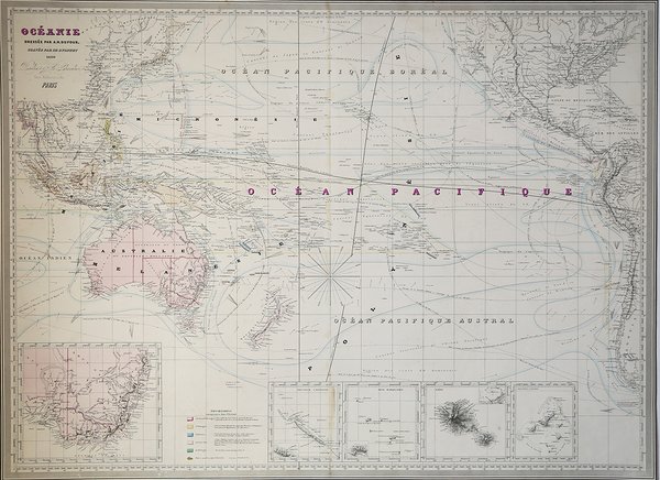
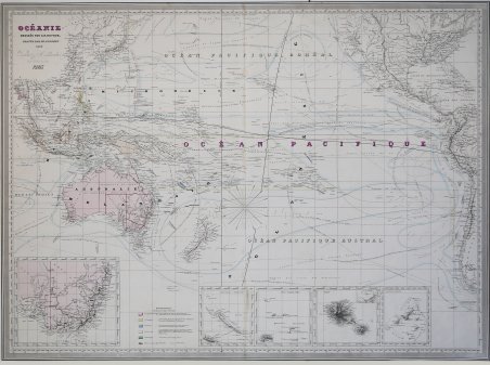
Description
Rara carta dell'Oceania tratta da "Atlas Universel " edita a Parigi e pubblicata del Dufour. Bella coloritura coeva. Scarce map of Oceana and the Pacific Ocean, from Dufour's Atlas Universel. Centered on Hawaii. Includes ocean currents and other details. Inset maps of New Caledonia, Tahiti, and the Marquesas.This is an impressive 1860 elephant folio map of Australia, New Zealand, Polynesia and the Pacific Ocean by A. H. Dufour. It covers from Burma (Myanmar) east as far as Chile and from Japan south to New Zealand. Although the interiors of the continents remain blank, the coastal regions are highly detailed. Numerous islands of Polynesia, Melanesia and Micronesia are noted. Five insets are features along the bottom border of the map. These include an inset of New South Wales, Australia, showing gold locations, New Caledonia, Martinique Island, Tahiti and the Gambier Archipelago.The map shows extraordinary detail throughout noting European possessions in Australia and southeast Asia, cities, islands, rivers, lakes, mountains, oceans and ocean currents, sea routes of explorers and a host of other geographical, topographical and physical features. Cfr. Rumsey 5020.044.
