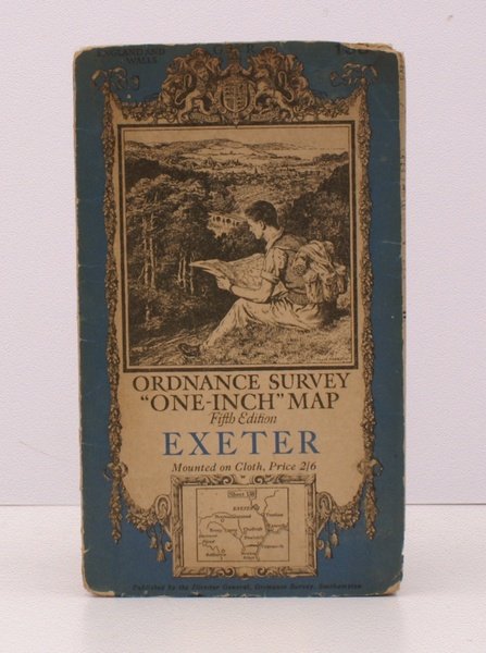
Ordnance Survey 'One-Inch' Map. Fifth Edition. Exeter. Sheet 138. [Scale: One Inch to One Mile]. BRIGHT, CLEAN COPY OF THE FIFTH EDITION
Libri antichi e moderni
Ordnance Survey
Ordnance Survey, Southampton,
1933
Ordnance Survey 'One-Inch' Map. Fifth Edition. Exeter. Sheet 138. [Scale: One Inch to One Mile]. BRIGHT, CLEAN COPY OF THE FIFTH EDITION
Libri antichi e moderni
Ordnance Survey
Ordnance Survey, Southampton,
1933
25,30 €
(Devon,
Regno Unito)
Metodi di Pagamento
- PayPal
- Carta di Credito
- Bonifico Bancario
- Pubblica amministrazione
- Carta del Docente
Dettagli
- Anno di pubblicazione
- 1933
- Autore
- Ordnance Survey
- Editori
- Ordnance Survey, Southampton
- Soggetto
- topography, cartography, maps, ordnance survey, exeter
- Lingue
- Inglese
Descrizione
Folding coloured map on cloth measuring 29 x 34 ins (approx. 73 x 86 cms) folding in 32 panels to 7.5 x 4.5 ins (approx. 17.7 x 10.1 cms), mild dust-soiling at folds; original pictorial card wrappers, upper cover chipped at upper edge else a very good, bright, clean copy. The One-Inch Fifth Edition began publication in 1932; Sheet 138 was first issued in 1933. The cover is Ellis Martin's 'hiker on hillside' in blue and black with location map. SCARCE IN THIS CONDITION. Browne, 23.2.ab.