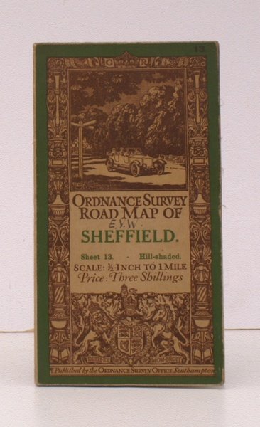
Ordnance Survey Road Map of Sheffield. Sheet 13. Hill-Shaded. Scale: Half-Inch to One Mile. BRIGHT, CLEAN COPY OF THE 1915 ISSUE
Libri antichi e moderni
Ordnance Survey
Ordnance Survey, Southampton,
1915
Ordnance Survey Road Map of Sheffield. Sheet 13. Hill-Shaded. Scale: Half-Inch to One Mile. BRIGHT, CLEAN COPY OF THE 1915 ISSUE
Libri antichi e moderni
Ordnance Survey
Ordnance Survey, Southampton,
1915
29,90 €
(Devon,
Regno Unito)
Metodi di Pagamento
- PayPal
- Carta di Credito
- Bonifico Bancario
- Pubblica amministrazione
- Carta del Docente
Dettagli
- Anno di pubblicazione
- 1915
- Autore
- Ordnance Survey
- Editori
- Ordnance Survey, Southampton
- Soggetto
- topography, cartography, maps, ordnance survey, sheffield
- Lingue
- Inglese
Descrizione
Folding coloured map on cloth measuring 21 x 30 ins (approx. 56 x 76 cms) folding in 24 panels to 7.0 x 4.0 ins (approx. 17.7 x 10.1 cms); original pictorial card wrappers, neat stamp on rear wrapper, a very good, bright, clean copy The Half-Inch Layered series with striking 'car and signpost' cover by Ellis Martin was first issued in in 1913; Sheet 13 was first published in 1915. The cover is 'car and signpost' in green and brown with green sheet name. SCARCE IN THIS CONDITION. Browne, 12.2a.