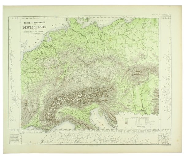
FLUSS UND BERGKARTE VON DEUTSCHLAND UND DES ANLIEGENDEN LANDERN - 1857.
FLUSS UND BERGKARTE VON DEUTSCHLAND UND DES ANLIEGENDEN LANDERN - 1857. | Libri antichi e moderni | Stieler Adolf.
Libri antichi e moderni
Stieler Adolf.
Justus Perthes,,
1871


FLUSS UND BERGKARTE VON DEUTSCHLAND UND DES ANLIEGENDEN LANDERN - 1857.
FLUSS UND BERGKARTE VON DEUTSCHLAND UND DES ANLIEGENDEN LANDERN - 1857. | Libri antichi e moderni | Stieler Adolf.
Libri antichi e moderni
Stieler Adolf.
Justus Perthes,,
1871
17,00 €
(Rivalba,
Italia)
Metodi di Pagamento
- PayPal
- Carta di Credito
- Bonifico Bancario
- Pubblica amministrazione
- Carta del Docente
Dettagli
- Anno di pubblicazione
- 1871
- Luogo di stampa
- Gotha
- Autore
- Stieler Adolf.
- Editori
- Justus Perthes,
- Soggetto
- ALPINISMO MONTAGNA, CARTE GEOGRAFICHE, EUROPA
Descrizione
(Codice VR/0668) Original copper engraved & hand-coloured map (cm 37,5x44,5 total dimensions) coming from an incomplete copy of the "HAND ATLAS über alle Theile der Erde und über das Weltgebäude", 1872. Mint conditions. Note: the map is sent folded up in four. ~~~ SPEDIZIONE IN ITALIA SEMPRE TRACCIATA
