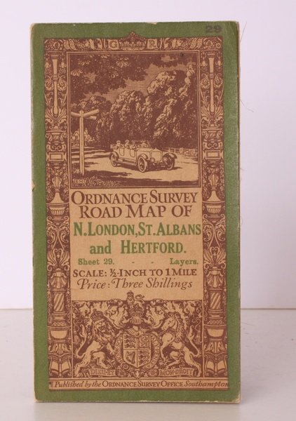
Ordnance Survey Road Map of N.London, St. Albans and Hertford. Sheet 29. Layers. Scale: ½ inch to 1 Mile. [With Ellis Martin's 'car & signpost' cover]. BRIGHT, CLEAN COPY
Ordnance Survey Road Map of N.London, St. Albans and Hertford. Sheet 29. Layers. Scale: ½ inch to 1 Mile. [With Ellis Martin's 'car & signpost' cover]. BRIGHT, CLEAN COPY | Libri antichi e moderni | Ordance Survey
Libri antichi e moderni
Ordance Survey
Ordnance Survey, [Southampton],
1925
20,70 €
(Devon,
Regno Unito)
Metodi di Pagamento
- PayPal
- Carta di Credito
- Bonifico Bancario
- Pubblica amministrazione
- Carta del Docente
Dettagli
- Anno di pubblicazione
- 1925
- Autore
- Ordance Survey
- Editori
- Ordnance Survey, [Southampton]
- Soggetto
- topography, maps, os, ordnance survey, london, st. albans, hertford, cartography, ellis martin
- Lingue
- Inglese
Descrizione
Folding coloured map on cloth measuring 28 x 30 ins (approx. 71.0 x 76.0 cms) folding in 32 panels to 7.0 x 3.75 ins (approx. 18.0 x 9.5 cms), some very light age-soiling; original pictorial card wrappers, wrappers lightly age-soiled, else a very good, bright, clean copy. The half-inch road maps were reduced from the one-inch map of 1903-08. This 1925 issue includes the 1924 revisions, with Ellis Martin's well-known 'car & signpost' cover in the green and brown variant. SCARCE. Browne, 12.2.a.
