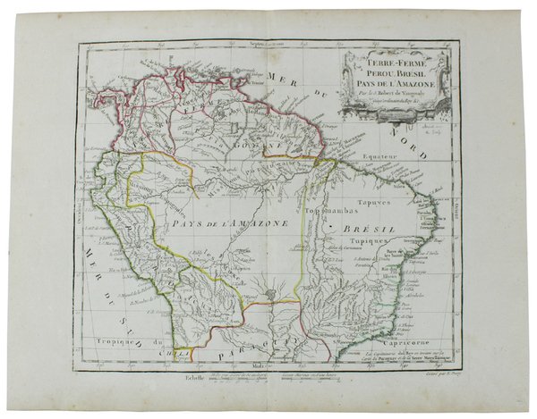
TERRE-FERME, PEROU, BRESIL, PAYS DE L'AMAZONE. [Original copper engraved map, 1778]
TERRE-FERME, PEROU, BRESIL, PAYS DE L'AMAZONE. [Original copper engraved map, 1778] | Libri antichi e moderni | Vaugondy (De) Robert, Dussy E.
Libri antichi e moderni
Vaugondy (De) Robert, Dussy E.
Chez le Sr. Fortin,,
1778
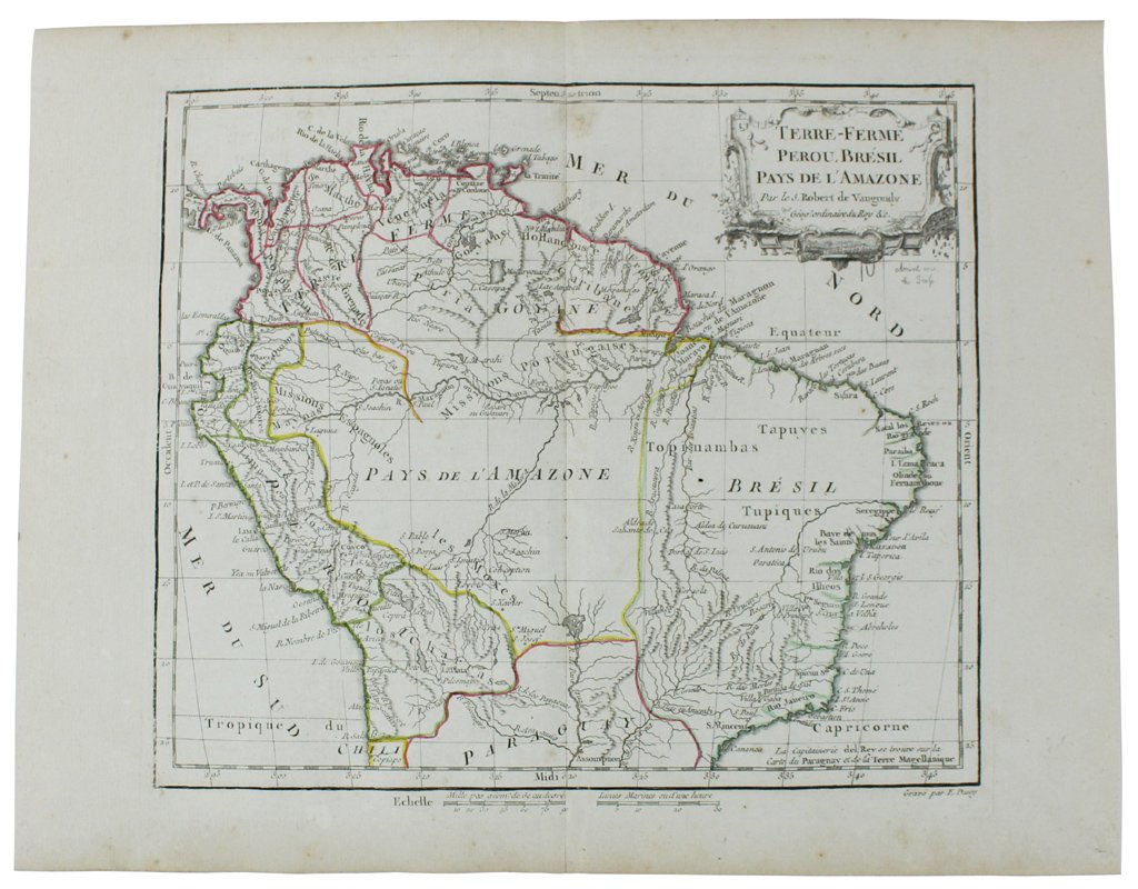
92,00 €
(Rivalba,
Italia)
Metodi di Pagamento
- PayPal
- Carta di Credito
- Bonifico Bancario
- Pubblica amministrazione
- Carta del Docente
Dettagli
- Anno di pubblicazione
- 1778
- Luogo di stampa
- Paris
- Autore
- Vaugondy (De) Robert, Dussy E.
- Editori
- Chez le Sr. Fortin,
- Soggetto
- CARTE GEOGRAFICHE, AMERICA LATINA CENTRO E SUD AMERICA
Descrizione
(Codice VS/0877) Antique original copper engraved map, with hand colored borders. Overall size : 290x370 mm., engraving size: 255x285 mm ca., comes from he "Nouvel Atlas Portatif pour la jeunesse, d'après La Géographie Moderne de feu l'Abbé Delacroix" (joined photocopy of the title page).Texts in french. The cartouches on the maps are engraved by Arrivet. Gilles Robert de Vaugondy (1688-1766), also known as Le Sieur or Monsieur Robert, and his son, Didier Robert de Vaugondy (c.1723-1786), were leading cartographers in France during the 18th century. Plate folded in two. In excellent condition. ~~~ SPEDIZIONE IN ITALIA SEMPRE TRACCIATA
