Anamba Islands
Anamba Islands | Stampe | Admiralty Charts
Stampe
Admiralty Charts
Anamba Islands
Anamba Islands | Stampe | Admiralty Charts
Stampe
Admiralty Charts
200,00 €
(Gavirate,
Italia)
Metodi di Pagamento
- PayPal
- Carta di Credito
- Bonifico Bancario
- Pubblica amministrazione
- Carta del Docente
Dettagli
- Formato
- mm 985x640
- Edizione
- '900
- Disegnatori
- Admiralty Charts
Descrizione
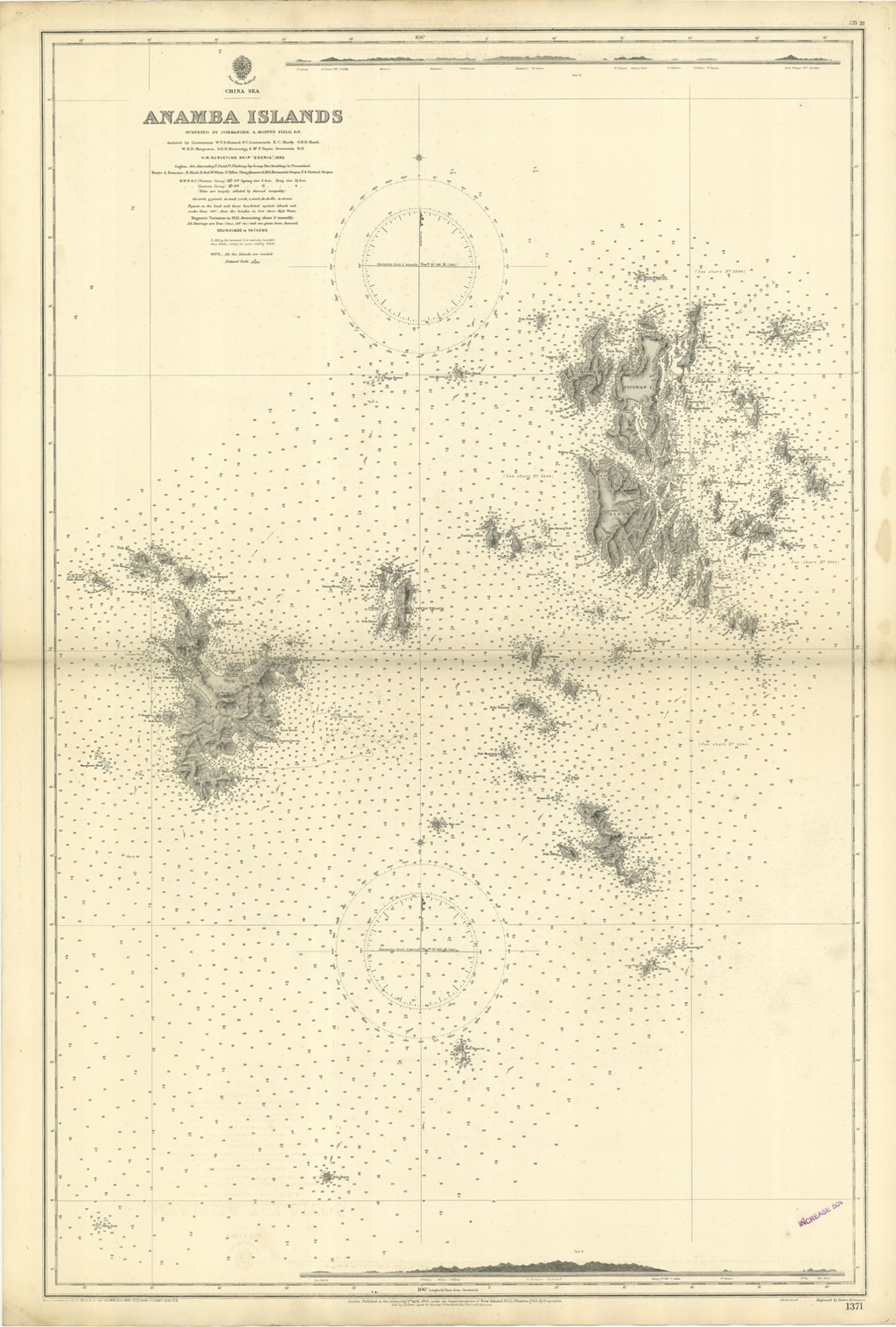
Anamba Islands Surveyed by Commander A. Mostyn Field. Assisted by Lieutenants W.V.S. Howard, F.C. Learmonth, E.C. Hardy, G.E.B. Hand, W.H.D. Margesson, D.E.R. Brownrigg, & Mr. F. Payne, Boatswain. H.M. Surveying ship "EGERIA", 1893.London Published at the Admiralty, 1st April 1895, under the Superintendence of Rear Admiral W.J.L. Wharton, Hydrographer. Small corrections: 1927. Folded
Anno di pubblicazione: '900
