Anchorages in the Fiji Islands
Anchorages in the Fiji Islands | Stampe | Admiralty Charts, Admiralty Charts
Anchorages in the Fiji Islands
Anchorages in the Fiji Islands | Stampe | Admiralty Charts, Admiralty Charts
Metodi di Pagamento
- PayPal
- Carta di Credito
- Bonifico Bancario
- Pubblica amministrazione
- Carta del Docente
Dettagli
- Formato
- mm 641x980
- Edizione
- '900
- Incisori
- Admiralty Charts
- Soggetto
- Fiji islands - Archipelago
- Disegnatori
- Admiralty Charts
- Lingue
- Italiano
Descrizione
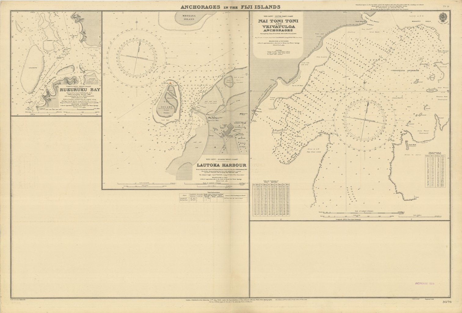
Anchorages in the Fiji Islands. In the upper left corner of the chart insert of Rukuruku Surveyed by Lieut. G.E. Richards, H.M. Surveying Ship "Renard"1882 with amendments by Lieut. M. Richmond H.M.S. "Laburnum"1927. Work in hairline enlarged from the original survey. In the middle of the chart insert of Lautoka Harbour From a Survey by Comm. S.E. Thomas & Lieut.-Comm. E.G. Rhodes, H.M.S. "Chatham", 1921. The portions shown in hairline have been much enlarged from a survey by Comm. J.W. Combe, H.M. Surveying Ship "Waterwitch", 1896. In the right side of the chart insert of Nai Toni Toni and Veivatuloa Anchorages Surveyed by Lieut. F.G.S. Peile H.M.S. "Torch", 1905. London Published at the Admiralty, 17th July 1906 under the Superintendence of Rear Admiral A. Mostyn Field, Hydrographer. Small corrections: 1929. Folded editorially. Autore: Admiralty Charts. Luogo: Fiji isole - Archipelago. Anno: '900. Tecnica: incisione. Dimensioni: 641x980 mm
Anno di pubblicazione: '900
