Bassein River to Pulo Penang including the Andaman and Nicobar Islands and the north coast of Sumatra
Bassein River to Pulo Penang including the Andaman and Nicobar Islands and the north coast of Sumatra | Stampe | Admiralty Charts
Stampe
Admiralty Charts
Bassein River to Pulo Penang including the Andaman and Nicobar Islands and the north coast of Sumatra
Bassein River to Pulo Penang including the Andaman and Nicobar Islands and the north coast of Sumatra | Stampe | Admiralty Charts
Stampe
Admiralty Charts
250,00 €
(Gavirate,
Italia)
Metodi di Pagamento
- PayPal
- Carta di Credito
- Bonifico Bancario
- Pubblica amministrazione
- Carta del Docente
Dettagli
- Formato
- mm 982x641
- Edizione
- '900
- Disegnatori
- Admiralty Charts
Descrizione
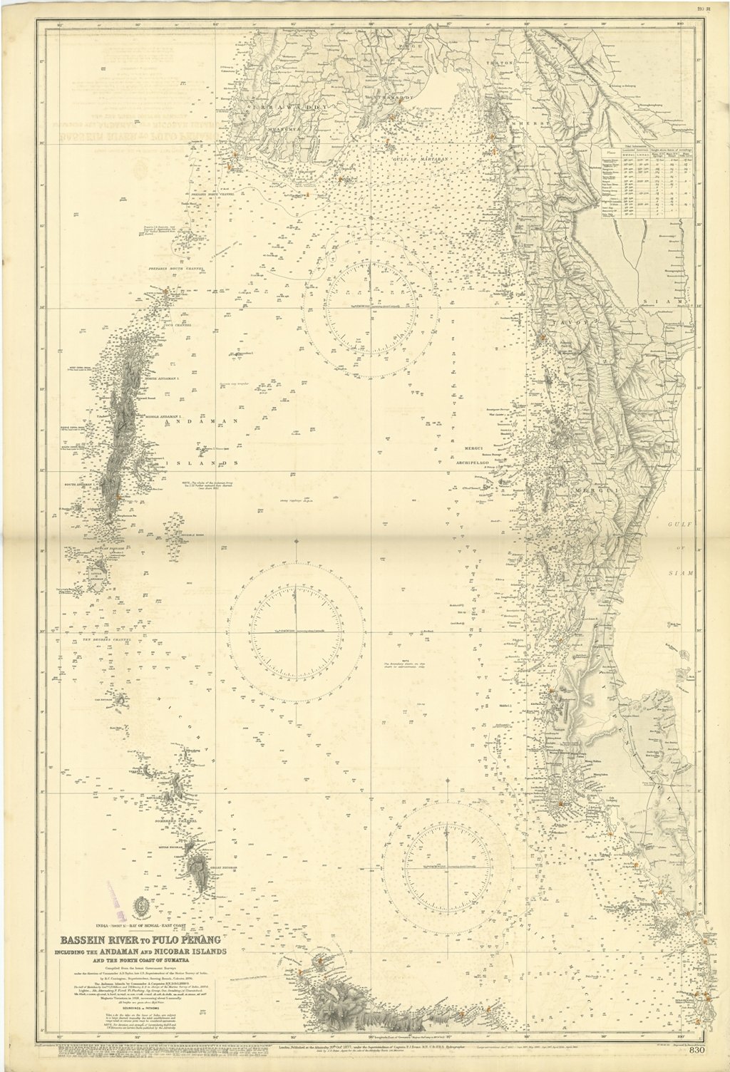
Bassein River to Pulo Penang including the Andaman and Nicobar Islands and the north coast of Sumatra Compiled from the latest Government Surveys under the direction of Commander A.D. Taylor, late I.N., Superintendent of the Marine Survey of India, by R.C. Carrington, Superintendent, Drawing Branch, Calcutta, 1876. The Andaman Island by Commander A. Carpenter, 1888-9. The Gulf of Martaban by Com. Oldham and Heming in charge of the Marine Survey of India, 1897-8.London Published at the Admiralty 20th Oct. 1877, under the Superintendence of Captain F.J. Evans, Hydrographer. Small corrections: 1931. Editorially folded
Anno di pubblicazione: '900
