Stampe
HONDIUS JODOCUS
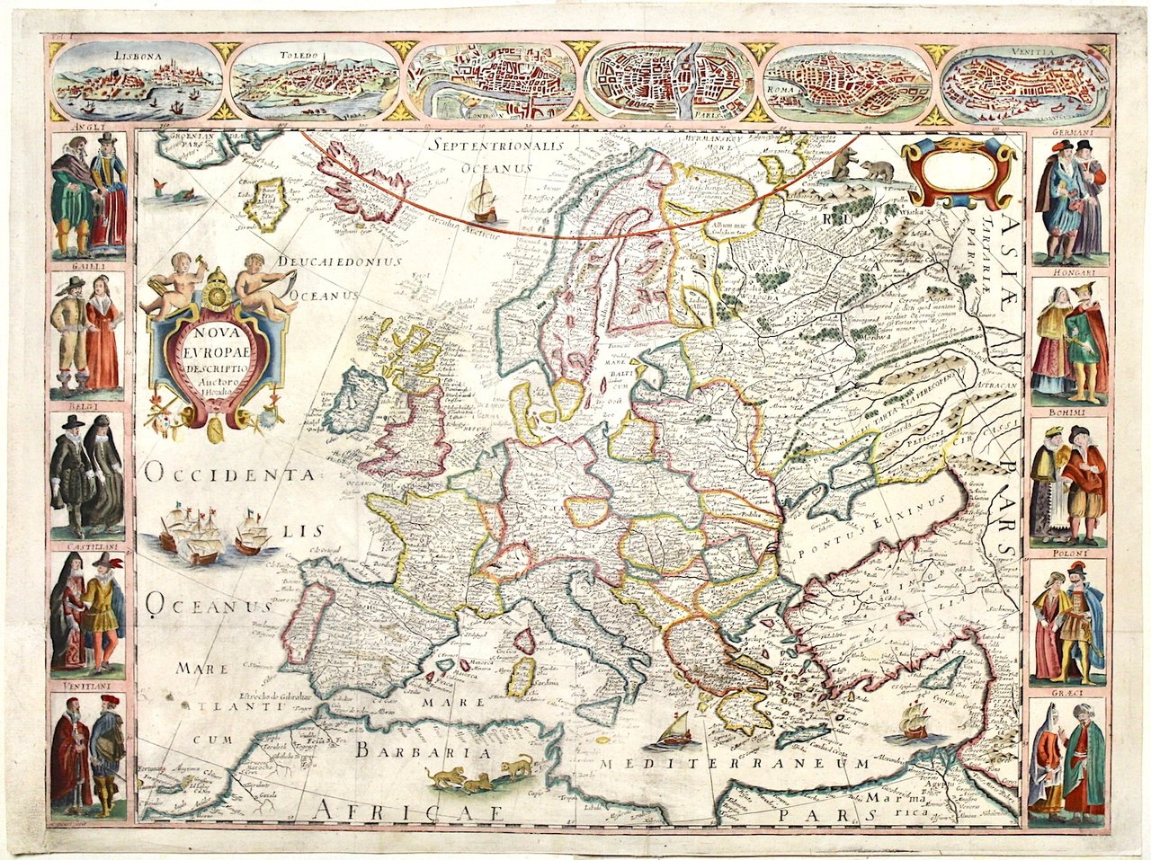
Nova Europae descriptio Auctoro Hondio
1659
non disponibile
Perini Libreria Antiquaria (Verona, Italia)
Parla con il LibraioLe corrette spese di spedizione vengono calcolate una volta inserito l’indirizzo di spedizione durante la creazione dell’ordine. A discrezione del Venditore sono disponibili una o più modalità di consegna: Standard, Express, Economy, Ritiro in negozio.
Condizioni di spedizione della Libreria:
Per prodotti con prezzo superiore a 300€ è possibile richiedere un piano rateale a Maremagnum. È possibile effettuare il pagamento con Carta del Docente, 18App, Pubblica Amministrazione.
I tempi di evasione sono stimati in base ai tempi di spedizione della libreria e di consegna da parte del vettore. In caso di fermo doganale, si potrebbero verificare dei ritardi nella consegna. Gli eventuali oneri doganali sono a carico del destinatario.
Clicca per maggiori informazioniMetodi di Pagamento
- PayPal
- Carta di Credito
- Bonifico Bancario
-

-
 Scopri come utilizzare
il tuo bonus Carta del Docente -
 Scopri come utilizzare
il tuo bonus 18App