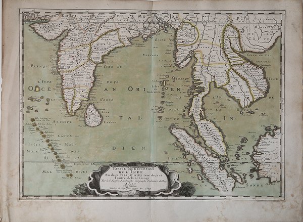
Partie Meridionale de l'Inde En deux Presqu'Isles l'une decà et l'autre de là le Gange
Partie Meridionale de l'Inde En deux Presqu'Isles l'une decà et l'autre de là le Gange | Stampe | SANSON Nicolas

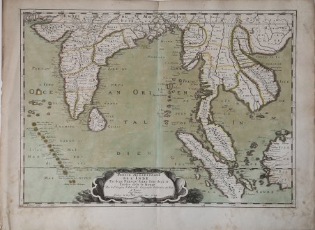
Partie Meridionale de l'Inde En deux Presqu'Isles l'une decà et l'autre de là le Gange
Partie Meridionale de l'Inde En deux Presqu'Isles l'une decà et l'autre de là le Gange | Stampe | SANSON Nicolas
Metodi di Pagamento
- PayPal
- Carta di Credito
- Bonifico Bancario
- Pubblica amministrazione
- Carta del Docente
Dettagli
- Anno di pubblicazione
- 1679
- Luogo di stampa
- Parigi
- Formato
- 530 X 380
- Incisori
- SANSON Nicolas
Descrizione
Importante carta geografica dell'India e del Sud-Est asiatico di Sanson, risalente al XVII secolo, con la data incisa 1679. Pubblicata per la prima volta nel 1654, poi inclusa nell'Atlas Les Cartes Générales de toutes parties du Monde, pubblicato per la prima volta nel 1658, copre la maggior parte dell'India moderna, il Bangladesh e La Birmania, l'intero Sri Lanka, Thailandia, Malesia, Laos, Cambogia e Vietnam, e parti dell'Indonesia e della Cina, e mostra città e piccoli insediamenti, fiumi e catene montuosee e divisioni politiche.Con cartiglio decorativo con titolo in basso al centro, in un'enorme conchiglia galleggiante sul mare: con l'equatore e il Tropico del Cancro segnati e le indicazioni di latitudine e longitudine sui bordi.Di notevole interesse storico.Incisione in rame, bella coloritura coeva, in ottimo stato di conservazione. Sanson's important mid-seventeenth century map of India and Southeast Asia, with the engraved date 1679.First published in 1654 and issued separately, then included in Sanson's Atlas Les Cartes Générales de toutes parties du Monde, first issued 1658. It covers most of modern India, Bangladesh and Burma, the whole of Sri Lanka, Thailand, Malaysia, Laos, Cambodia, and Vietnam, and parts of Indonesia and China, showing the cities and smaller settlements, rivers and mountain chains, as well as the borders of the seventeenth-century kingdoms and other major political divisions, most of them further subdivided.With decorative title and imprint in a cartouche at the foot in the form of a cloth in an enormous shell floating on the sea: with the equator and Tropic of Cancer marked and latitude and longitude indications in the borders.It was engraved by J. Somer for the elder Nicolas Sanson, dated 1654 and with a privilege for twenty years, and appeared in Sanson's 1658 Cartes generales de toutes les parties du monde and later editions. Of considerable historical interest for the state of European knowledge of India and Southeast Asia in the mid-seventeenth century.Copperplate with fine original colour, very good condition. Cfr.
