Plans in the Southern part of Celebes
Plans in the Southern part of Celebes | Stampe | Admiralty Charts
Plans in the Southern part of Celebes
Plans in the Southern part of Celebes | Stampe | Admiralty Charts
Metodi di Pagamento
- PayPal
- Carta di Credito
- Bonifico Bancario
- Pubblica amministrazione
- Carta del Docente
Dettagli
- Formato
- mm 636x477
- Edizione
- '900
- Soggetto
- Indonesia - Celebes Sea
- Disegnatori
- Admiralty Charts
Descrizione
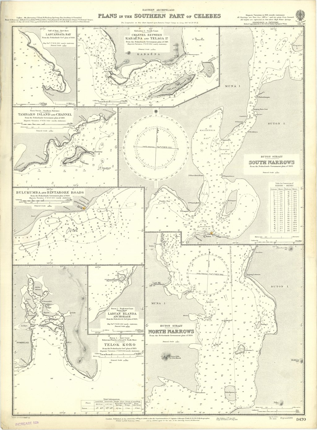
Plans in the Southern part of Celebes - Magnetic Variation in 1921, nearly stationary.In the left side of the chart insert of Labuandata Bay From the Netherlands Gov.t plan of 1920, Tambako Island and Channel From the Netherlands Government plan of 1919, Bulukumba and Bintarore Roads From the Netherlands Government Plan of 1920, Labuan Blanda Anchorage From the Netherlands Gov.t Plan of 1920, Telok Koro From the Netherlands Government plan of 1919. In the upper part insert of Channel between Kabaena and Telaga I.s From the Netherlands Government Plan of 1919. In the right side insert of South Narrows From the Netherlands Government plan of 1920 and North Narrows From the Netherlands Government plan of 1920.London Published at the Admiralty 30th April 1906, under the Superintendence of Captain A. Mostyn Field, Hydrographer. Small corrections: 1927. 636x477 mm
Anno di pubblicazione: '900
