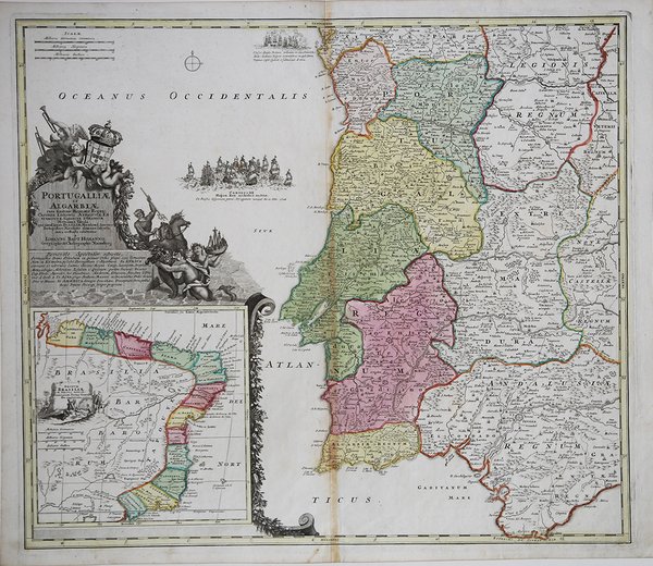
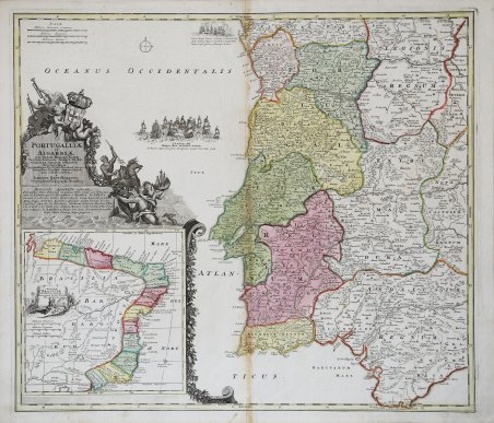
Portugalliae et Algarbiae cum finitiis Hispaniae Regnis…Novissima Tabula
Portugalliae et Algarbiae cum finitiis Hispaniae Regnis…Novissima Tabula | Stampe | HOMANN Johann Baptist

Portugalliae et Algarbiae cum finitiis Hispaniae Regnis…Novissima Tabula
Portugalliae et Algarbiae cum finitiis Hispaniae Regnis…Novissima Tabula | Stampe | HOMANN Johann Baptist
Metodi di Pagamento
- PayPal
- Carta di Credito
- Bonifico Bancario
- Pubblica amministrazione
- Carta del Docente
Dettagli
- Anno di pubblicazione
- 1716
- Luogo di stampa
- Norimberga
- Formato
- 573 X 495
- Incisori
- HOMANN Johann Baptist
Descrizione
Interessante carta storico-geografica, che mostra il Portogallo e la sua colonia sudamericana: il Brasile. Come tutte le carte di Homann, è estremamente accurata e dettagliata. Il cartiglio decorativo mostra lo stemma reale sorretto da cherubini, mentre nel mar Atlantico sono rappresentate due battaglie navali relative alla guerra di successione spagnola, nella quale il Portogallo fu parte della Grande Alleanza opposta alla Spagna. Johann Baptist Homann è stato un geografo e cartografo tedesco; nel 1702 fondò la sua casa editrice. Homann acquisì fama come uno dei principali cartografi tedeschi, e nel 1715 fu nominato geografo imperiale dall'imperatore Carlo VI. Nello stesso anno fu anche nominato membro dell'Accademia Prussiana delle Scienze a Berlino. Nel 1716 Homann pubblicò il suo capolavoro Grosser Atlas ueber die ganze Welt. Numerose mappe furono redatte in collaborazione con l'incisore Christoph Weigel. Homann morì a Norimberga nel 1724. Gli successe suo figlio Johann Christoph (1703-1730). L'azienda continuò dopo la sua morte come azienda degli eredi Homann, gestita da Johann Michael Franz e Johann Georg Ebersberger. Dopo successivi cambiamenti nella gestione, l'azienda si sciolse nel 1852. ' Incisione su rame, coloritura coeva, tracce di colla lungo la piega centrale, per il resto in ottime condizioni. Interesting map that links Portugal with her colony in South America in a beautiful composition. The map is filled with impressive detail of Portugal. However, it is the addition of a large inset of Brazil showing the capitanias that makes the map outstanding. The exquisite title cartouche fills the remaining area above the inset with Neptune, merfolk, cherubs, and the royal coat of arms. Two sea battle from the War of the Spanish Succession are depicted in the Atlantic, in which Portugal was a part of the Grand Alliance against Spain. Johann Baptist Homann was a German geographer and cartographer; in 1702 he founded his own publishing house. Homann acquired renown as a leading German cartographer, and in 1715 was appointed Imperial Geographer by Emperor Charles VI. In the same year he was also named a member of the Prussian Academy of Sciences in Berlin. In 1716 Homann published his masterpiece Grosser Atlas ueber die ganze Welt; numerous maps were drawn up in cooperation with the engraver Christoph Weigel the Elder. Homann died in Nuremberg in 1724 and was succeeded by his son Johann Christoph (1703-1730). The company carried on upon his death as Homann heirs company, managed by Johann Michael Franz and Johann Georg Ebersberger. After subsequent changes in management the company folded in 1852. ' Copper engraving, original colors, browning at the center fold, in good conditions. Cfr.
