Pulo Berhala to Cape Rachado - Malacca Strait
Pulo Berhala to Cape Rachado - Malacca Strait | Stampe | Admiralty Charts
Stampe
Admiralty Charts
Pulo Berhala to Cape Rachado - Malacca Strait
Pulo Berhala to Cape Rachado - Malacca Strait | Stampe | Admiralty Charts
Stampe
Admiralty Charts
300,00 €
(Gavirate,
Italia)
Metodi di Pagamento
- PayPal
- Carta di Credito
- Bonifico Bancario
- Pubblica amministrazione
- Carta del Docente
Dettagli
- Formato
- mm 754x991
- Edizione
- '900
- Soggetto
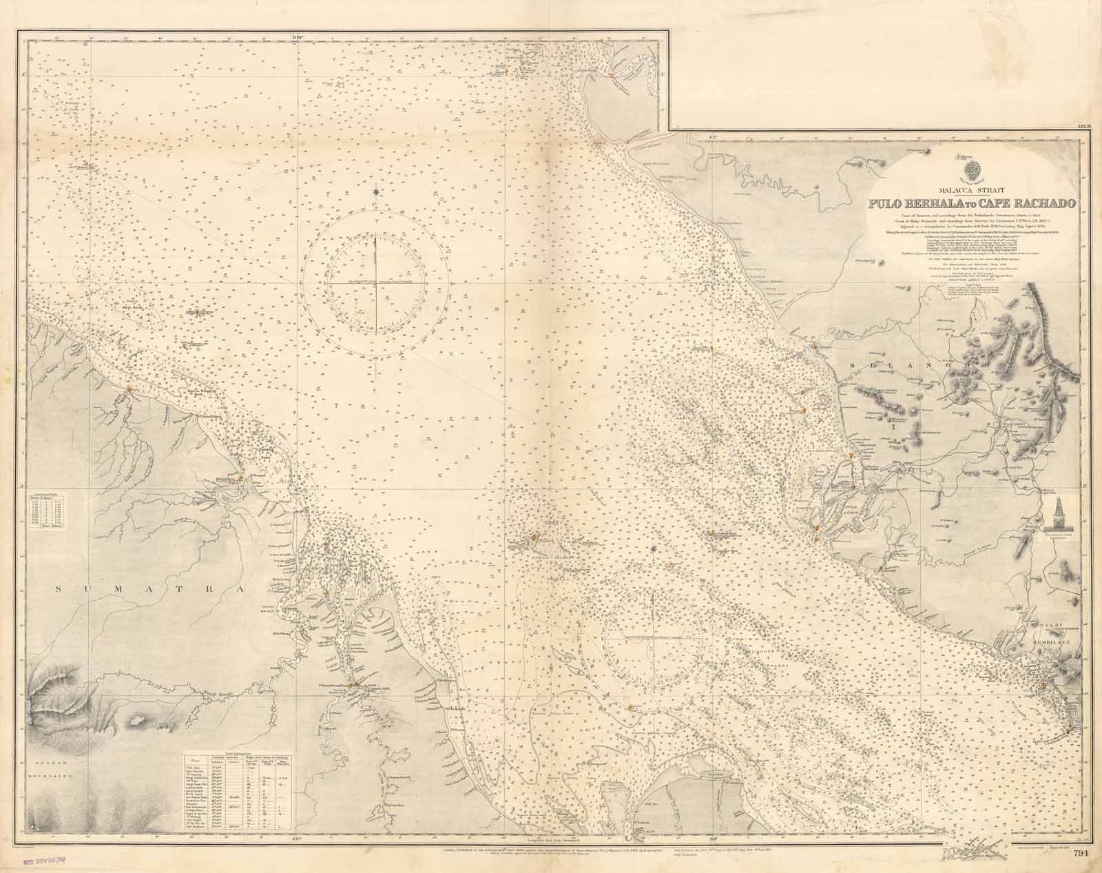
- Malacca Strait - Selangor
- Disegnatori
- Admiralty Charts
Descrizione
Coast of Sumatra and soundings from the Netherlands Government Chart to 1928. Coast of Malay Peninsula and soundings from Surveys by Lieutenant C.Y. Ward 1852-5. Adjusted to a triangulation by Commander A. M. Field H. M. Surveying Ship "Egeria" 1893. Klang Strait and approaches from the Survey by Lieutenant and Commander H. P. Douglas H. M. Surveying Ship "Waterwitch" 1908. London Published at the Admiralty 8 Oct.r. 1895 under the superintendence of Rear Admiral W. J. L. Wharton Hydrographer. Large corrections: 4 Sept. 1931. Editorially folded
Anno di pubblicazione: '900
