Sketch Plans of Anchorages between Mindanao and Celebes
Sketch Plans of Anchorages between Mindanao and Celebes | Stampe | Admiralty Charts
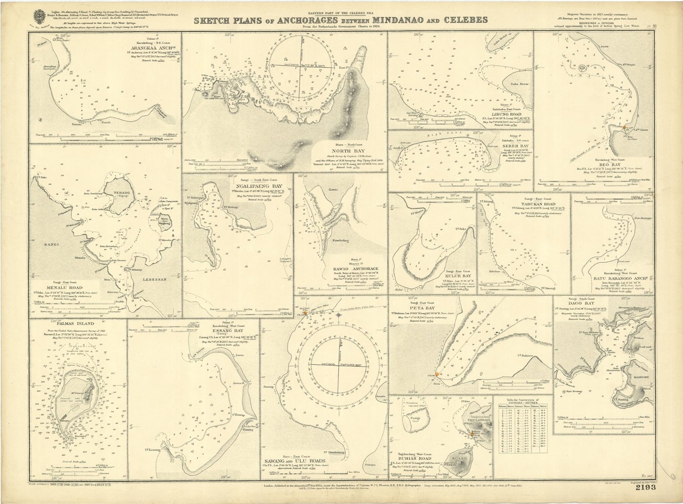
Sketch Plans of Anchorages between Mindanao and Celebes
Sketch Plans of Anchorages between Mindanao and Celebes | Stampe | Admiralty Charts
Metodi di Pagamento
- PayPal
- Carta di Credito
- Bonifico Bancario
- Pubblica amministrazione
- Carta del Docente
Dettagli
- Formato
- mm 463x645
- Edizione
- '900
- Soggetto
- Indonesia - Celebes Sea
- Disegnatori
- Admiralty Charts
Descrizione
Sketch Plans of Anchorages between Mindanao and Celebes From the Netherlands Government Charts to 1924 - Magnetic Variation in 1927, nearly stationary. In the left side of the chart insert of Arangkaa Anch.ge, Menalu Road, Menala Island From the United States Government Survey of 1915, Essang Bay. In the middle part insert of North Bay, Ngalipaeng Bay, Kawio Anchorage, Sawang and Ulu Roads. In the right side insert of Lirung Road, Sereh Bay, Beo Bay, Kulur Bay, Tabukan Road, Batu Baranggo Anch.e, Peta Bay, Dago Bay and Buhias Road. London Published at the Admiralty 15th Marc. 1893, under the Superintendence of Captain W.J.L. Wharton, Hydrographer. Small corrections: 1929. Autore: Admiralty Charts. Luogo: Indonesia - Celebes Sea. Anno: '900. Dimensioni: 463x645 mm
Anno di pubblicazione: '900
