Tonga or Friendly Islands
Tonga or Friendly Islands | Stampe | Admiralty Charts, Admiralty Charts
Tonga or Friendly Islands
Tonga or Friendly Islands | Stampe | Admiralty Charts, Admiralty Charts
Metodi di Pagamento
- PayPal
- Carta di Credito
- Bonifico Bancario
- Pubblica amministrazione
- Carta del Docente
Dettagli
- Formato
- mm 965x652
- Edizione
- '900
- Incisori
- Admiralty Charts
- Soggetto
- Pacific Ocean - Island Tonga
- Disegnatori
- Admiralty Charts
- Lingue
- Italiano
Descrizione
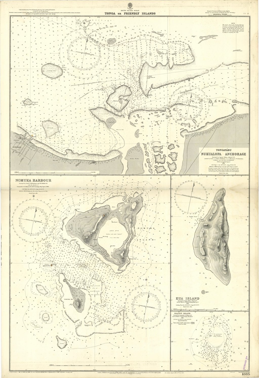
Tonga or Friendly Islands. In the upper part of the chart insert of Tongatabu Nukualofa Anchorage Surveyed by Captain Pelham Aldrich, assisted by Lieuts. C.J. Baker, T.H. Heming, G.C.A. Marescaux, W. Richardson, C.E. Monro and Sub Lieut. E.B. Kiddle, H.M. Surveying Ship "Egeria", 1888. In the lower part of the chart insert of Nomuka Harbour Surveyed by Lieut.ts W. Richardson and E.B. Kiddle, under the direction of Commander C.F. Oldham, H.M. Surveying Ship "Egeria", 1889, Eua Island Surveyed by Captain Pelham Aldrich, and the Officers of H.M. Surveying Ship "Egeria" 1888, Falcon Island Surveyed by Commander C.F. Oldham, and the Officers of H.M. Surveying Ship "Egeria" 1889. London Published at the Admiralty, 15th Feb. 1890, under the Superintendence of Captain W.J.L. Wharton, Hydrographer. Small corrections: 1931. Folded editorially. Autore: Admiralty Charts. Luogo: Pacific Ocean - Island Tonga. Anno: '900. Tecnica: incisione. Dimensioni: 965x652.
Anno di pubblicazione: '900
