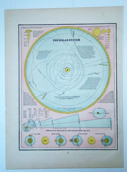
1889 Map of the Solar System, Illustrating Comparative Distances of the Planets From the Sun
Libros antiguos y modernos
Artist Unknown
W.H. Stewart,
1889
1889 Map of the Solar System, Illustrating Comparative Distances of the Planets From the Sun
Libros antiguos y modernos
Artist Unknown
W.H. Stewart,
1889
99,95 €
(Ladysmith,
Canadá)
Formas de Pago
- PayPal
- Tarjeta de crédito
- Transferencia Bancaria
- Pubblica amministrazione
- Carta del Docente
Detalles
- Año de publicación
- 1889
- Lugar de impresión
- Rochester, NY
- Autor
- Artist Unknown
- Editores
- W.H. Stewart
- Formato
- Folio - over 12" - 15" tall
- Edición
- First Edition Thus
- Materia
- 1889 Map of the Solar System, Illustrating Comparative Distances of the Planets From the Sun, planet sizes, neap tides, spring tides, lunar eclipse and solar Eclipse Maps Antiquarian
- Descripción
- Map
- Conservación
- Muy bueno
- Idiomas
- Inlgés
- Primera edición
- True
Descripción
Vintage color map. Includes illustrations of comparative planet sizes, neap tides, spring tides, lunar eclipse and solar eclipse. Outer dimensions: 10.75" x 14.5". Unmarked with Light wear. Book