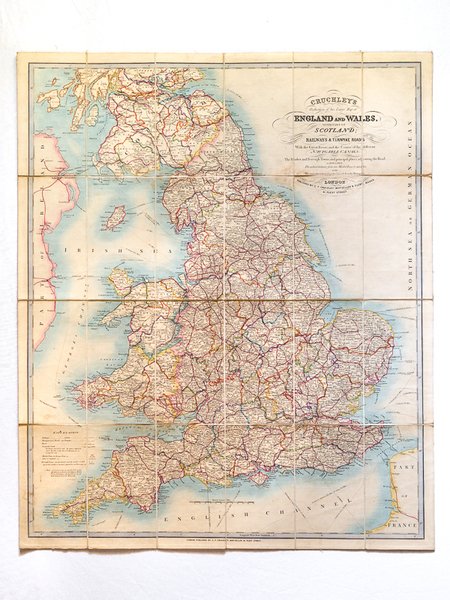
Cruchley's Reduction of his Large Map of England and Wales with Part of Scotland ; Showing all the Railways & Turnpike Roads with the Great Rivers and the course of the different Navigable Canals : The Market and Borough Towns and principal places adjoining the Road
Libros antiguos y modernos
Cruchley, G. F., [ Cruchley, George Frederick ]
G. F. Cruchley,
1852
395,00 €
(GRADIGNAN,
Francia)
Formas de Pago
- PayPal
- Tarjeta de crédito
- Transferencia Bancaria
- Pubblica amministrazione
- Carta del Docente
Detalles
- Año de publicación
- 1852
- Autor
- Cruchley, G. F., [ Cruchley, George Frederick ]
- Editores
- G. F. Cruchley
- Materia
- Histoire 07 Géographie English Royaume-Uni
- Idiomas
- Inlgés
Descripción
Colored folding map, mounted on linen, G. F. Cruchley, 81 Fleet Street, London, s.d. [ circa 1850-1860 ], 79 x 66,5 cm. Full title : Cruchley's Reduction of his Large Map of England and Wales with Part of Scotland ; Showing all the Railways & Turnpike Roads with the Great Rivers and the course of the different Navigable Canals : The Market and Borough Towns and principal places adjoining the Road ; to which is added the distance from one market town to another, with the exact admeasurement prefixed to each from the metropolis. Nice map in its original colors (slight browning on foldings, otherwise a charming map).