OKLAHOMA AND INDIAN TERS MAP OF THE OKLAHOMA COUNTRY IN THE INDIAN TERRITORY
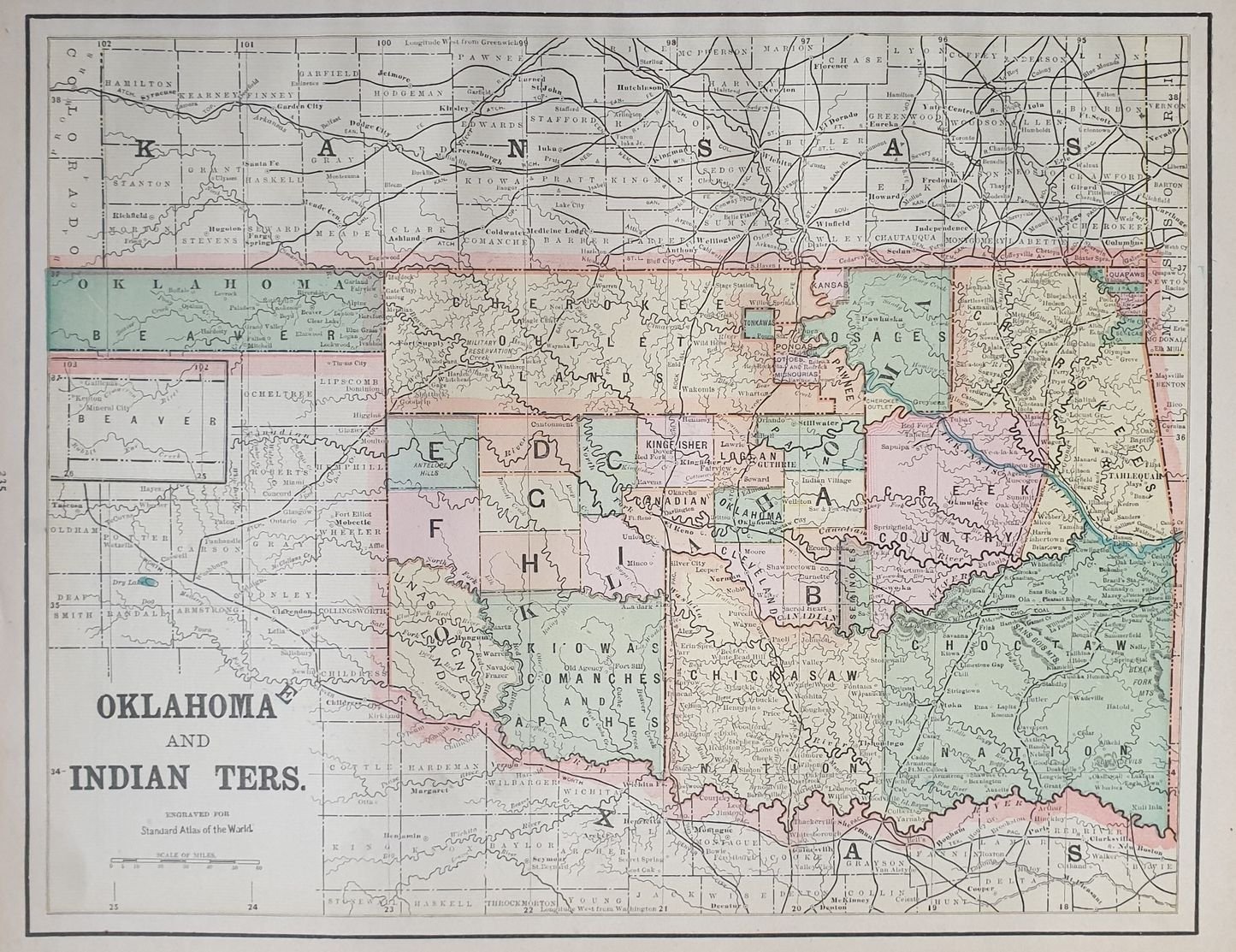
OKLAHOMA AND INDIAN TERS MAP OF THE OKLAHOMA COUNTRY IN THE INDIAN TERRITORY
Formas de Pago
- PayPal
- Tarjeta de crédito
- Transferencia Bancaria
- Pubblica amministrazione
- Carta del Docente
Detalles
- Autor
- George F. Cram
Descripción
Bellissima mappa colorata dell'Oklahoma nel territorio indiano. Al verso mappa colorata di Atlanta e Charleston. Autore: George F. Cram Atlante: Standard American atlas of the world Data: 1890 circa Tecnica: litografia Dimensione del foglio: 36,5x29 cm Dimensione dell'incisione: 33x26 cm Condizioni:Buone. Alcune gore di umidità marginali.Very beautiful page coloured map of Oklahoma in indian territory. In the verso coloured map of Atlanta and Charleston. Author: George F. Cram Atlas: Standard American atlas of the world Date: 1890 circa Technique: lythography Leaf Dimension: 36,5x29 cm Engraving Dimension: 33x26 cm Conditions: Good conditions. Some little water stains in the edges.<BR><BR>