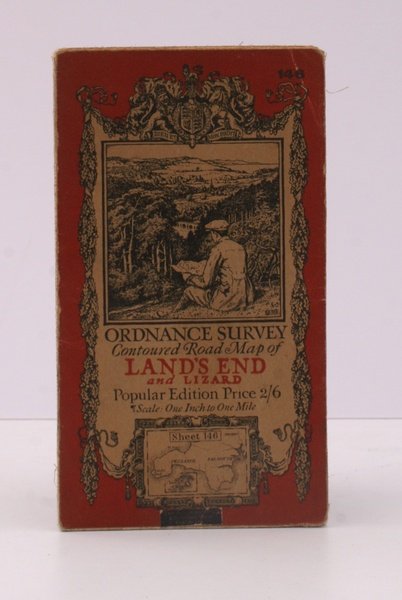
Ordnance Survey Contoured Road Map of Land's End and Lizard. Popular Edition. One Inch. Sheet 146. [Ellis Martin cover].
Ordnance Survey Contoured Road Map of Land's End and Lizard. Popular Edition. One Inch. Sheet 146. [Ellis Martin cover]. | Libros antiguos y modernos | Ordnance Survey
Libros antiguos y modernos
Ordnance Survey
Ordnance Survey, [Southampton,
1925
23,00 €
(Devon,
Reino Unido)
Formas de Pago
- PayPal
- Tarjeta de crédito
- Transferencia Bancaria
- Pubblica amministrazione
- Carta del Docente
Detalles
- Año de publicación
- 1925
- Autor
- Ordnance Survey
- Editores
- Ordnance Survey, [Southampton
- Materia
- topography, land's end, lizard, os, ordnance survey, maps, ordnance survey, topography, maps, ordnance, survey, contoured, road, map, land's, end, lizard
- Idiomas
- Inlgés
Descripción
Folding coloured map on cloth measuring 22.0 x 28.5 ins (approx. 56.0 x 72.0 cms) folding in 21 panels to 7.5 x 4.25 ins (approx. 19.0 x 11.0 cms), covers lightly dust-soiled else a very good, bright, clean copy. The famous Popular Edition One Inch series was first published in 1919 with striking 'hiker' artwork by Ellis Martin. The present copy is the 1925 revision; the covers are the dark red and black variant with location map. Browne, 11.2.a
