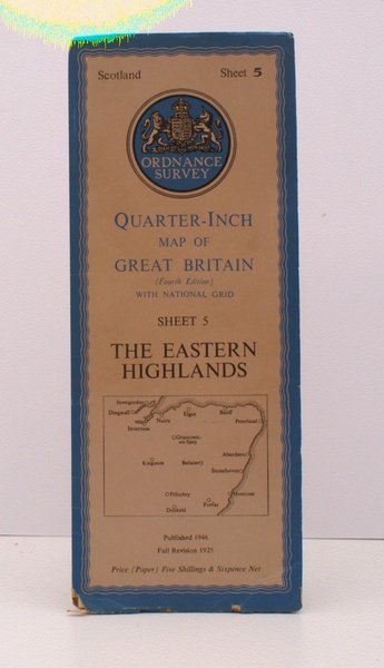
Ordnance Survey.Quarter-Inch Map. The Eastern Highlands. Fourth Edition with National Grid. Sheet 5. [Scale: Quarter-Inch to One Mile]. BRIGHT, CLEAN COPY OF THE 1946 ISSUE
Libros antiguos y modernos
Ordnance Survey
Ordnance Survey, Chessington,
1946
Ordnance Survey.Quarter-Inch Map. The Eastern Highlands. Fourth Edition with National Grid. Sheet 5. [Scale: Quarter-Inch to One Mile]. BRIGHT, CLEAN COPY OF THE 1946 ISSUE
Libros antiguos y modernos
Ordnance Survey
Ordnance Survey, Chessington,
1946
18,40 €
(Devon,
Reino Unido)
Formas de Pago
- PayPal
- Tarjeta de crédito
- Transferencia Bancaria
- Pubblica amministrazione
- Carta del Docente
Detalles
- Año de publicación
- 1946
- Autor
- Ordnance Survey
- Editores
- Ordnance Survey, Chessington
- Materia
- topography, cartography, maps, ordnance survey, eastern highlands, ellis martin
- Idiomas
- Inlgés
Descripción
Folding coloured map on paper measuring 24.0 x 35.0 ins (approx. 61 x 89 cms) folding in 16 panels to 12.5 x 5.0 ins (approx. 32.0 x 13 cms); printed card covers, a very good, bright, clean copy. The cover is Ellis Martin's 'Medallion Royal Arms' with blue border and location map, in long format. The generic form of this design became the first standard post-war OS cover. Browne, 96.2.a.