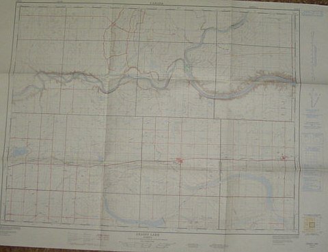
Map of Grassy Lake, Alberta, West of Fourth Meridian, Scale 1:50,000
Map of Grassy Lake, Alberta, West of Fourth Meridian, Scale 1:50,000 | Libros antiguos y modernos | No Author
Libros antiguos y modernos
No Author
Surveys and Mapping Branch, Department of Energy, Mines and - Resources,
1975
Map of Grassy Lake, Alberta, West of Fourth Meridian, Scale 1:50,000
Map of Grassy Lake, Alberta, West of Fourth Meridian, Scale 1:50,000 | Libros antiguos y modernos | No Author
Libros antiguos y modernos
No Author
Surveys and Mapping Branch, Department of Energy, Mines and - Resources,
1975
79,95 €
(Ladysmith,
Canadá)
Formas de Pago
- PayPal
- Tarjeta de crédito
- Transferencia Bancaria
- Pubblica amministrazione
- Carta del Docente
Detalles
- Año de publicación
- 1975
- Lugar de impresión
- Canada
- Autor
- No Author
- Editores
- Surveys and Mapping Branch, Department of Energy, Mines and, Resources
- Edición
- F First Edition
- Materia
- Map of Grassy Lake, Alberta, West of Fourth Meridian, Scale 1:50, 000 Sherburne Lake Fincastle Lake South Saskatchewan River, Burdett Old Man River Bow River Taber Municipality Forty Mile, County Purple Springs 25 foot contours, water bodies, roads, rail lines, Structures Maps Alberta
- Descripción
- Map
- Conservación
- Muy bueno
- Idiomas
- Inlgés
- Primera edición
- True
Descripción
36" x 25.5". Indicates 25 foot contours, water bodies, roads, rail lines, structures, etc. Light wear. Unmarked. Book
