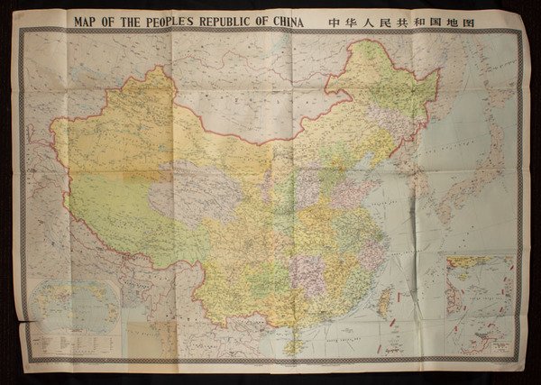
Map of the Peoples Republic of China. [Chinese Map with Inset of South China Sea Islands].
Map of the Peoples Republic of China. [Chinese Map with Inset of South China Sea Islands]. | Libros antiguos y modernos |
Libros antiguos y modernos
Cartographic Publishing House Beijing 1984.,
Map of the Peoples Republic of China. [Chinese Map with Inset of South China Sea Islands].
Map of the Peoples Republic of China. [Chinese Map with Inset of South China Sea Islands]. | Libros antiguos y modernos |
Libros antiguos y modernos
Cartographic Publishing House Beijing 1984.,
30,00 €
(Roma,
Italia)
Formas de Pago
- PayPal
- Tarjeta de crédito
- Transferencia Bancaria
- Pubblica amministrazione
- Carta del Docente
Detalles
- Editores
- Cartographic Publishing House Beijing 1984.
- Materia
- CINA China Chine
- Sobrecubierta
- False
- Conservación
- Bueno
- Copia autógrafa
- False
- Primera edición
- False
Descripción
Large colour folding map of China, 114.5 x 162cm. Features inset maps of South China Sea Islands and a world map showing China's Geographic Location at lower corners. Scale 1:4000,000. Text in Pinyin, English and Chinese characters. Shows administrative regions correct to December 1983; boundaries, water features, capitals, towns, villages, shipping and other transport routes.
