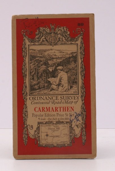
Ordnance Survey Contoured Road Map of Carmarthen. Popular Edition. One Inch. Sheet 89. [Ellis Martin cover].
Ordnance Survey Contoured Road Map of Carmarthen. Popular Edition. One Inch. Sheet 89. [Ellis Martin cover]. | Libros antiguos y modernos | Ordnance Survey
Libros antiguos y modernos
Ordnance Survey
Ordnance Survey, [Southampton,
1923
23,00 €
(Devon,
Reino Unido)
Formas de Pago
- PayPal
- Tarjeta de crédito
- Transferencia Bancaria
- Pubblica amministrazione
- Carta del Docente
Detalles
- Año de publicación
- 1923
- Autor
- Ordnance Survey
- Editores
- Ordnance Survey, [Southampton
- Materia
- topography, carmarthen, os, ordnance survey, maps, ordnance survey, topography, maps, ordnance, survey, contoured, road, map, carmarthen
- Idiomas
- Inlgés
Descripción
Folding coloured map on cloth measuring 22.0 x 28.5 ins (approx. 56.0 x 72.0 cms) folding in 21 panels to 7.5 x 4.25 ins (approx. 19.0 x 11.0 cms), small neat contemporary signature on front wrapper else a very good, bright, clean copy. The famous Popular Edition One Inch series was first published in 1919 with striking 'hiker' artwork by Ellis Martin. The present copy is the 1923; the covers are the dark red and black variant with location map. Browne, 11.2.a
