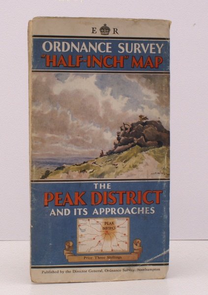
Ordnance Survey Half-Inch Map. The Peak District and its Approaches. [Scale: Half-Inch to One Mile]. BRIGHT, CLEAN COPY OF THE SOLE ISSUE WITH UNIQUE COVER
Ordnance Survey Half-Inch Map. The Peak District and its Approaches. [Scale: Half-Inch to One Mile]. BRIGHT, CLEAN COPY OF THE SOLE ISSUE WITH UNIQUE COVER | Libros antiguos y modernos | Ordnance Survey
Libros antiguos y modernos
Ordnance Survey
Ordnance Survey, Southampton,
1936
50,60 €
(Devon,
Reino Unido)
Formas de Pago
- PayPal
- Tarjeta de crédito
- Transferencia Bancaria
- Pubblica amministrazione
- Carta del Docente
Detalles
- Año de publicación
- 1936
- Autor
- Ordnance Survey
- Editores
- Ordnance Survey, Southampton
- Materia
- topography, cartography, maps, ordnance survey, peak district, jct willis, john christopher temple willis
- Idiomas
- Inlgés
Descripción
Folding coloured map on cloth measuring 32 x 41.5 ins (approx. 81 x 105 cms) folding in 40 panels to 8.0 x 4.5 ins (approx. 20.0 x 12.0 cms); original pictorial card wrappers, some light dust-soiling, a very good, bright, clean copy. SOLE ISSUE. The cover is Willis' 'Rock outcrop and view west'. THIS COVER DESIGN IS UNIQUE, AND SCARCE IN THIS CONDITION. Browne, 70.
