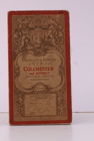
Ordnance Survey Map of Colchester and District. Coloured Edition. One Inch, Sheet 99. [Ellis Martin cover].
Ordnance Survey Map of Colchester and District. Coloured Edition. One Inch, Sheet 99. [Ellis Martin cover]. | Libros antiguos y modernos | Ordnance Survey
Libros antiguos y modernos
Ordnance Survey
Ordnance Survey, [Southampton,
1914
41,40 €
(Devon,
Reino Unido)
Formas de Pago
- PayPal
- Tarjeta de crédito
- Transferencia Bancaria
- Pubblica amministrazione
- Carta del Docente
Detalles
- Año de publicación
- 1914
- Autor
- Ordnance Survey
- Editores
- Ordnance Survey, [Southampton
- Materia
- topography, colchester, os, ordnance survey, maps, ordnance survey, topography, maps, ordnance, survey, map, colchester, district
- Idiomas
- Inlgés
Descripción
Folding coloured map on cloth measuring 21.x 28.5 ins (approx. 53.0 x 72.0 cms) folding in 24 panels to 7.0 x 3.5 ins (approx. 18.0 x 9.0 cms); original pictorial card wrappers covers lightly browned else a very good bright clean copy. The One Inch Coloured Edition dates from 1904. The present copy is the 1914 reissue; the covers are Ellis Martin's Royal Arms with mantling, dark red and brown variant. Browne, 10.2. SCARCE.
