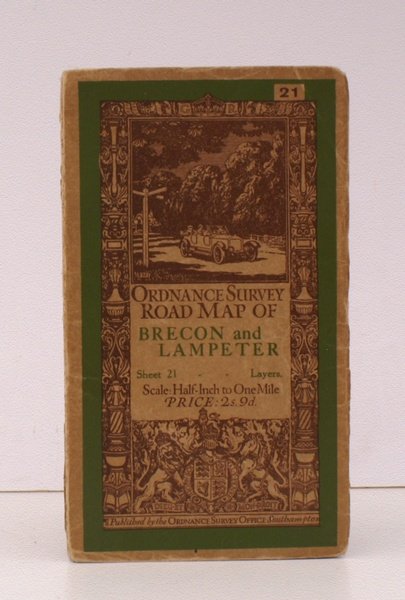
Ordnance Survey Road Map of Brecon and Lampeter. Sheet 21. Layers. Scale: Half-Inch to One Mile. BRIGHT, CLEAN COPY OF THE 1936 ISSUE
Ordnance Survey Road Map of Brecon and Lampeter. Sheet 21. Layers. Scale: Half-Inch to One Mile. BRIGHT, CLEAN COPY OF THE 1936 ISSUE | Libros antiguos y modernos | Ordnance Survey
Libros antiguos y modernos
Ordnance Survey
Ordnance Survey, Southampton,
1936
29,90 €
(Devon,
Reino Unido)
Formas de Pago
- PayPal
- Tarjeta de crédito
- Transferencia Bancaria
- Pubblica amministrazione
- Carta del Docente
Detalles
- Año de publicación
- 1936
- Autor
- Ordnance Survey
- Editores
- Ordnance Survey, Southampton
- Materia
- topography, cartography, maps, ordnance survey, brecon, lampeter
- Idiomas
- Inlgés
Descripción
Folding coloured map on cloth measuring 22 x 30 ins (approx. 56 x 76 cms) folding in 21 panels to 7.0 x 4.0 ins (approx. 17.7 x 10.1 cms); original pictorial card wrappers, neat stamp on rear wrapper, a very good, bright, clean copy The Half-Inch Layered series with striking 'car and signpost' cover by Ellis Martin was first issued in in 1913; Sheet 21 was first published in that year. The cover is 'car and signpost' in green and brown with green sheet name. This is the 1936 revision. SCARCE IN THIS CONDITION. Browne, 12.2a.
