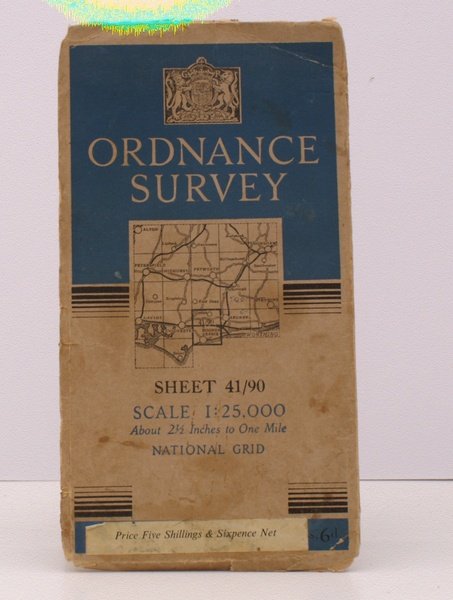
Ordnance Survey Two and a Half Inch Map. [Petersfield. Chichester. Worthing]. Sheet 41/90. Scale: 1: 25,000. Two and a Half Inches to One Mile. BRIGHT, CLEAN COPY
Ordnance Survey Two and a Half Inch Map. [Petersfield. Chichester. Worthing]. Sheet 41/90. Scale: 1: 25,000. Two and a Half Inches to One Mile. BRIGHT, CLEAN COPY | Libros antiguos y modernos | Ordnance Survey
Libros antiguos y modernos
Ordnance Survey
Ordnance Survey, Southampton,
1949
13,80 €
(Devon,
Reino Unido)
Formas de Pago
- PayPal
- Tarjeta de crédito
- Transferencia Bancaria
- Pubblica amministrazione
- Carta del Docente
Detalles
- Año de publicación
- 1949
- Autor
- Ordnance Survey
- Editores
- Ordnance Survey, Southampton
- Materia
- topography, cartography, maps, ordnance survey, petersfield, chichester, worthing, bognor, horsham
- Idiomas
- Inlgés
Descripción
Folding coloured map on cloth measuring 21.0 x 18.0 ins (approx. 53 x 45 cms) folding in 12 panels to 9.0 x 5.0 ins (approx. 22 x 13 cms), one or two tears at folds; original pictorial card wrappers, some light dust-soiling else a good, bright, clean copy. The 1:25000 Provision Edition was published from 1945 onwards. The cover is Vann's 'Six Lines' in blue and black with index map on buff. . Browne, 98.1.
