Rand McNally & Co's 1895 Map of the Main Portion of Philadelphia
Rand McNally & Co's 1895 Map of the Main Portion of Philadelphia | Libros antiguos y modernos | Author Not Stated
Libros antiguos y modernos
Author Not Stated
Rand McNally,
1902
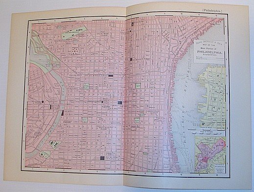
Rand McNally & Co's 1895 Map of the Main Portion of Philadelphia
Rand McNally & Co's 1895 Map of the Main Portion of Philadelphia | Libros antiguos y modernos | Author Not Stated
Libros antiguos y modernos
Author Not Stated
Rand McNally,
1902
89,95 €
(Ladysmith,
Canadá)
Formas de Pago
- PayPal
- Tarjeta de crédito
- Transferencia Bancaria
- Pubblica amministrazione
- Carta del Docente
Detalles
- Año de publicación
- 1902
- Lugar de impresión
- USA
- Autor
- Author Not Stated
- Editores
- Rand McNally
- Formato
- Folio - over 12" - 15" tall
- Edición
- F First Edition
- Materia
- Philadelphia History Pennsylvania Downtown Maps
- Descripción
- Map
- Conservación
- Muy bueno
- Idiomas
- Inlgés
- Primera edición
- True
Descripción
Outside dimensions 14.5" x 10.5" Circa 1902. Railroads and Street Car Lines indicated. Centerfold. Light wear. Please see our photo for details. Book
