Grabados
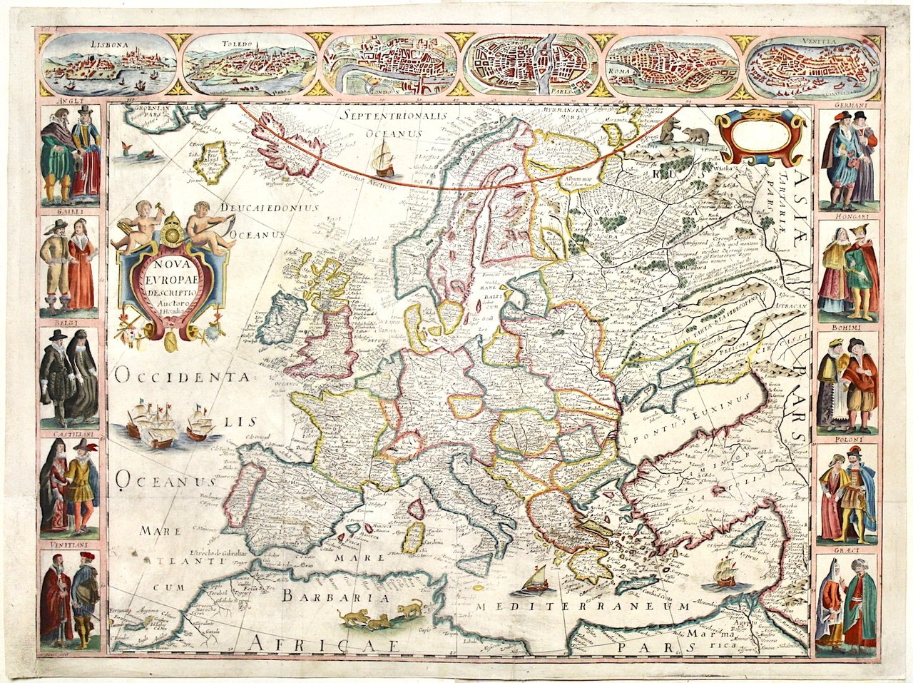
HONDIUS JODOCUS
Nova Europae descriptio Auctoro Hondio
1659
no disponible
Perini Libreria Antiquaria (Verona, Italia)
Habla con el libreroLos gastos de envío correctos se calculan una vez añadida la dirección de envío durante la creación del pedido. El vendedor puede elegir uno o varios métodos de envío: standard, express, economy o in store pick-up.
Condiciones de envío de la Librería:
Para los productos con un precio superior a 300 euros, es posible solicitar un plan de pago a plazos al Maremagnum. El pago puede efectuarse con Carta del Docente, Carta della cultura giovani e del merito, Administración Pública.
Los plazos de entrega se estiman en función de los plazos de envío de la librería y del transportista. En caso de retención aduanera, pueden producirse retrasos en la entrega. Los posibles gastos de aduana corren a cargo del destinatario.
Pulsa para saber másFormas de Pago
- PayPal
- Tarjeta de crédito
- Transferencia Bancaria
-

-
 Descubre cómo utilizar
tu Carta del Docente -
 Descubre cómo utilizar
tu Carta della cultura giovani e del merito