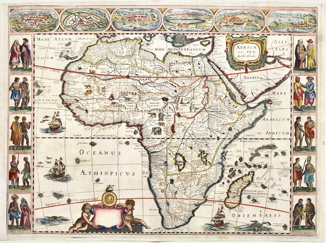
Africa nova tabula Auct: Jud: Hondio
Africa nova tabula Auct: Jud: Hondio | Grabados | HONDIUS JODOCUS


Africa nova tabula Auct: Jud: Hondio
Africa nova tabula Auct: Jud: Hondio | Grabados | HONDIUS JODOCUS
Formas de Pago
- PayPal
- Tarjeta de crédito
- Transferencia Bancaria
- Pubblica amministrazione
- Carta del Docente
Detalles
- Año de publicación
- 1659
- Lugar de impresión
- Lyon
- Editor
- Claude de la Riviere
- Grabadores
- HONDIUS JODOCUS
Descripción
Copper engraving, mm 415x555, colored. Very rare "carte a figures" from "Les Estats, Empires, Royaumes et Principautez du Monde" by Pierre d'Avity (1673-1735). He first published his work in 1614, but it was continually enlarged, even after his death. The 1659 posthumous edition was the first to contain four maps of the continents. Although it bears the name of Jodocus Hondius, the map is based upon the second state of Janssonius' map of 1623 even if the first derivative map is the Hondius, 1618. The map is embellished by vessels, fish and sea-mosters, 10 vignettes with costumes at the borders and 6 view on top (Kairo, Alexandria, Alger, Tunis, Tanger, Ceuta)Very good condition. Bottom left blank margin added (10 cm)<BR>
