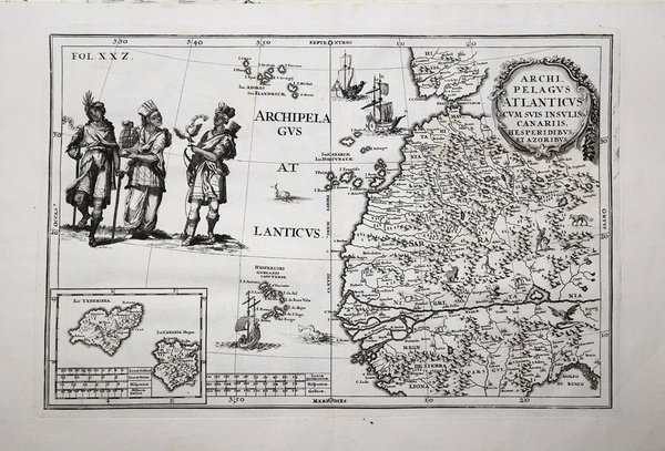
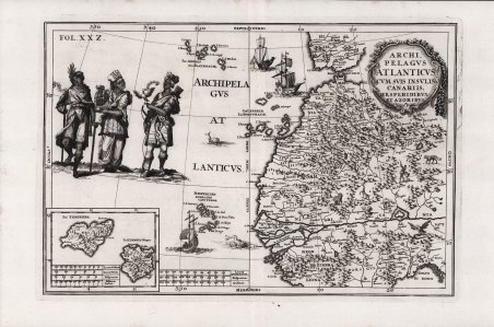
Archipelagus Atlanticus cum suis insulis Canariis, Hesperidibus, et Azoribus
Archipelagus Atlanticus cum suis insulis Canariis, Hesperidibus, et Azoribus | Grabados | SCHERER Henrick

Archipelagus Atlanticus cum suis insulis Canariis, Hesperidibus, et Azoribus
Archipelagus Atlanticus cum suis insulis Canariis, Hesperidibus, et Azoribus | Grabados | SCHERER Henrick
Formas de Pago
- PayPal
- Tarjeta de crédito
- Transferencia Bancaria
- Pubblica amministrazione
- Carta del Docente
Detalles
- Año de publicación
- 1702
- Lugar de impresión
- Monaco
- Formato
- 355 X 238
- Grabadores
- SCHERER Henrick
- Descripción
- Shirley (BL Atlases) T.SHER-1a #158.
Descripción
Affascinante carta geografica che copre la regione della Macaronesia che include le isole Canarie, le Azzorre e Capo Verde.La carta è riccamente decorata con le figure di tre indigeni, un bel cartiglio decorativo per il titolo. Decorativa carta geografica pubblicata nell'opera di Heinrich Scherer ' Atlas Novus exhibens orbem terraguem per naturae opera, historiae navae acveterus monumenta, artistique geographicae leges et praecepta ' edita in 8 parti, stampate tra il 1702 e il 1710 a Monaco di Baviera. Heinrich Scherer, professore di matematica a Monaco di Baviera, era un gesuita devoto la cui opera sottolineava la gerarchia cattolica e la diffusione delle missioni gesuite in tutto il mondo. Il suo ' Atlas Novus ' contiene mappe di tutte le altre parti che mostravano la diffusione del cattolicesimo e delle missioni gesuite. Incisione su rame, in ottimo stato di conservazione. Striking map depicting the northwestern portion of the continent, extending to southern Spain and the Strait of Gibraltar. By Heinrich Scherer (1628-1704) for his Atlas Novus exhibens orbem terraguem per naturae opera, historiae navae acveterus monumenta, artistique geographicae leges et praecepta.published in eight volumes from 1702-1710 in Munich. Scherer, a devout Jesuit, produced this geographical compendium to depict the Catholic hierarchy and the spread of Jesuit missions throughout the world. The interior is fully engraved with depictions of mountains, forests, rivers, cities, and a number of animals, including lions, giraffes, and elephants. The Azores, Canary Islands and Cape Verde Islands are well depicted, and an inset of Tenerira and Canary appears at bottom left. The map is richly ornamented with a decorative title cartouche, ships, sea monsters, and three large native figures holding three birds native to the region: an accipter, a canary and a flamingo. Cfr. Shirley (BL Atlases) T.SHER-1a #158.
