Belgium Foederatum emendaté auctum et novissimé editum
Grabados
WIT Frederick de
1680
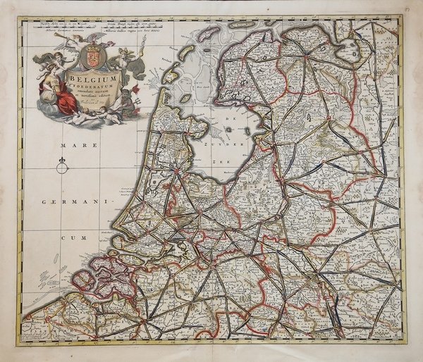
Belgium Foederatum emendaté auctum et novissimé editum
Grabados
WIT Frederick de
1680
375,00 €
(Roma,
Italia)
Formas de Pago
- PayPal
- Tarjeta de crédito
- Transferencia Bancaria
- Pubblica amministrazione
- Carta del Docente
Detalles
- Año de publicación
- 1680
- Lugar de impresión
- Amsterdam
- Formato
- 560 X 480
- Grabadores
- WIT Frederick de
Descripción
Carta geografica tratta dal “Atlas Major”, edizione di Amsterm circa 1700.Incisione in rame, bellissima coloritura coeva. Fine detailed map of the area of the modern Netherlands less the southern part of Limburg. Title cartouche representing the commerce, the arts and the sciences. The Lion of the Netherlands and compass-rose and rhumb-lines below the cartouche.Taken from the “Atlas Major”.Copperplate with contemporary hand colour, in good conditions. Cfr.