Canada ou Nouvelle France, Suivant les Nouvelles Observations de Messrs. de l'Academie Royale des Sciences
Canada ou Nouvelle France, Suivant les Nouvelles Observations de Messrs. de l'Academie Royale des Sciences | Grabados | VAN DER AA PIETER
Grabados
VAN DER AA PIETER
1713-1729
Canada ou Nouvelle France, Suivant les Nouvelles Observations de Messrs. de l'Academie Royale des Sciences
Canada ou Nouvelle France, Suivant les Nouvelles Observations de Messrs. de l'Academie Royale des Sciences | Grabados | VAN DER AA PIETER
Grabados
VAN DER AA PIETER
1713-1729
600,00 €
(Verona,
Italia)
Formas de Pago
- PayPal
- Tarjeta de crédito
- Transferencia Bancaria
- Pubblica amministrazione
- Carta del Docente
Detalles
- Año de publicación
- 1713-1729
- Lugar de impresión
- Leida
- Grabadores
- VAN DER AA PIETER
- Materia
- Canada
Descripción
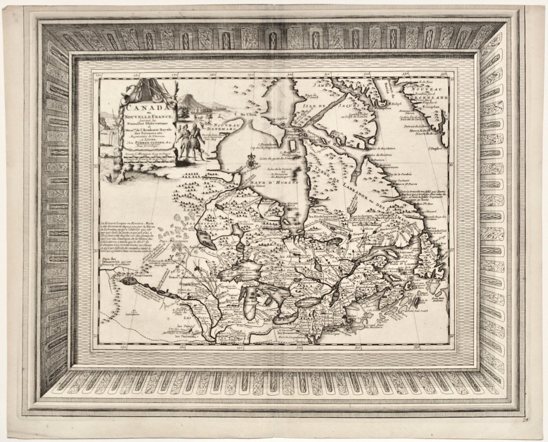
Copper engraving, mm 335x410. Scarce state of Vander Aa's map of Canada and the Great Lakes.<BR>Nice example, with the picture frame border, which appeared in Vander Aa's Gallerie Agreable du Monde, published in 1729 c.<BR>The map, based upon De L'Isle's map of 1703, extends east from Maryland to Greenland and west to the Plains. It is focusing on the Great Lakes Region and Upper Mississippi and shows many Indian tribes and several forts in the region. Pieter van der Aa (1659-1733) was a Dutch mapmaker and publisher, best known for his voluminous output of maps and atlases. Very good conditon, upper margin trimmed along the frame<BR>Kershaw, Early Printed Maps of Canada 328.<BR>
