Carta marina nuova tavola
Carta marina nuova tavola | Grabados | GASTALDI GIACOMO/RUSCELLI GIOVANNI
Carta marina nuova tavola
Carta marina nuova tavola | Grabados | GASTALDI GIACOMO/RUSCELLI GIOVANNI
Formas de Pago
- PayPal
- Tarjeta de crédito
- Transferencia Bancaria
- Pubblica amministrazione
- Carta del Docente
Detalles
- Año de publicación
- 1561
- Lugar de impresión
- Venezia
- Grabadores
- GASTALDI GIACOMO/RUSCELLI GIOVANNI
- Materia
- mappamondo
Descripción
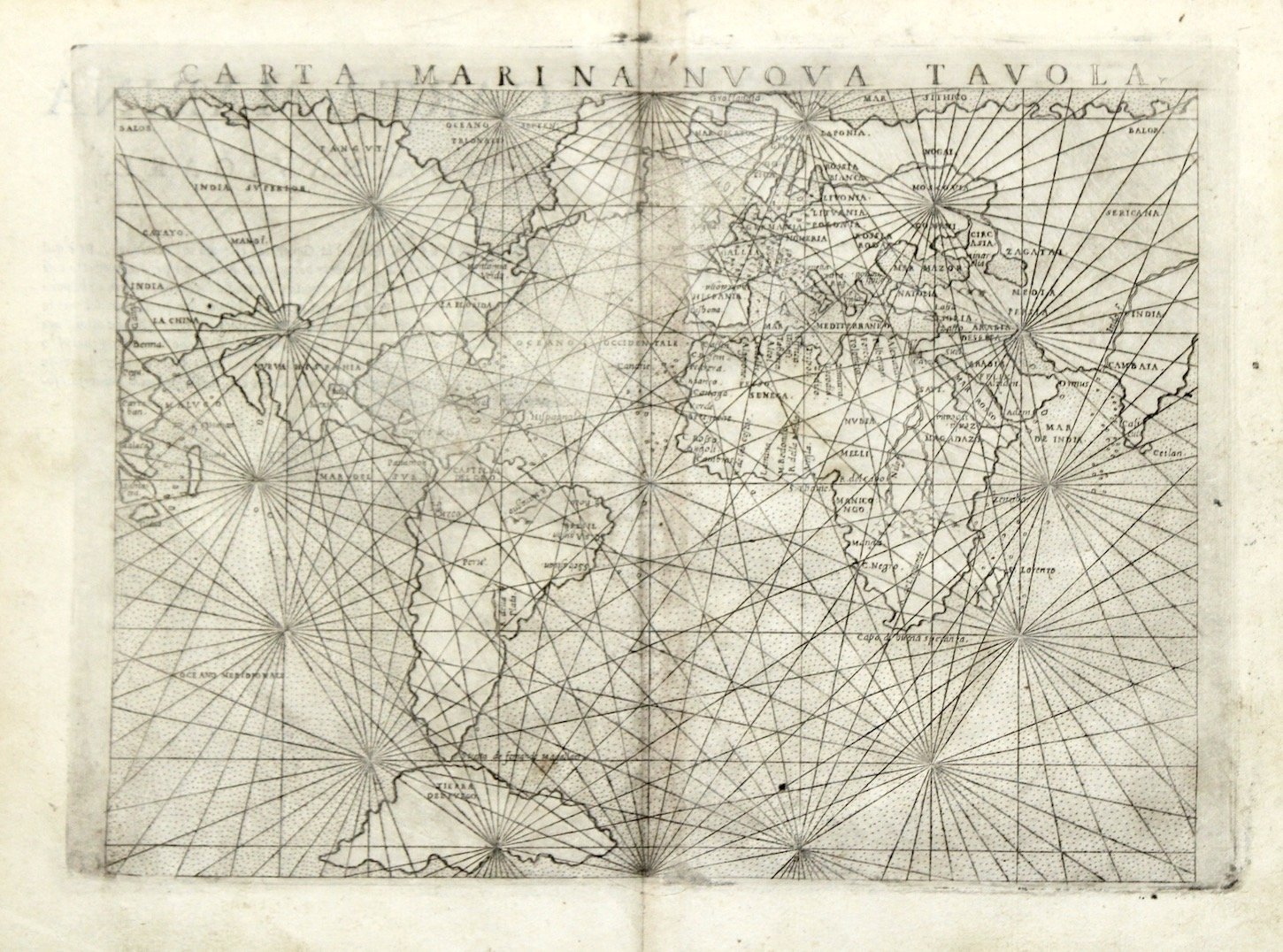
Copper engraving, mm 175x240. Ruscelli's mariner's map is a slightly enlarged version of the map which appeared in Gastaldi's edition of Ptolemy thirteen years earlier. It features a stipple engraved sea and numerous rhumb lines radiating from seventeen focal points. The only change seems to be the omissions of the names Tierra Del Laborador and Tierra Del Bacalaos from the mass of land joining North America to North Europe. The map contains only minimal interior detail but includes several important ports and trading posts including, Zanzibar on the east coast of Africa and Cambay, one of India’s two main ocean ports, visited by Marco Polo in 1293. The Magellan Strait, at the southern tip of South America is labelled and Tierra del Fuego is shown as a very large island. The map appeared in 1562, 1564, 1574 and in Giuseppe Rosaccio's expended edition of Girolamo Russelli Geografia in 1598 and 1599. Girolamo Ruscelli's edition of Ptolemy's Geographia included newly engraved copperplates by Giulio and Livio Sanuto. A fairly good impression, good condition, very light paper discoloration at centerfold. Shirley, World, 111; Burden p. 34, Schilder p.123
